Land use in Cambridgeshire
Bildnummer 11746622
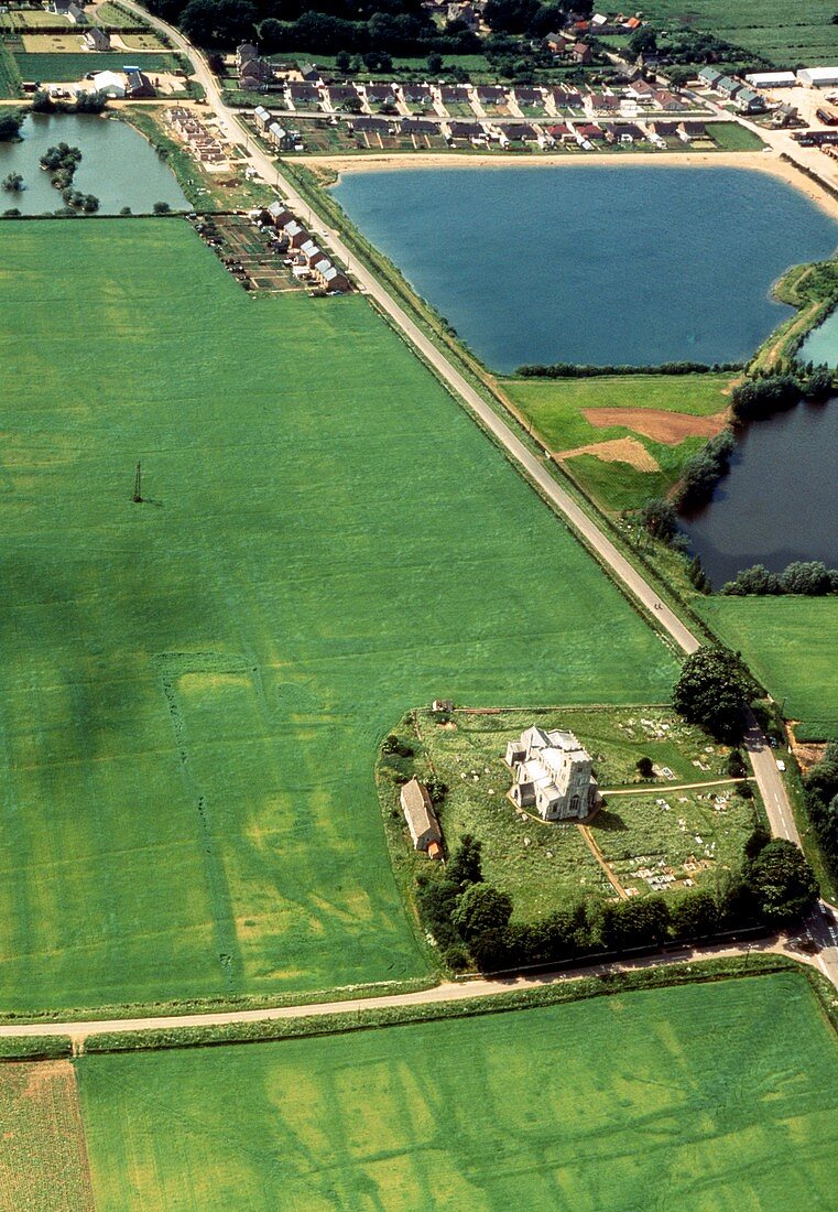
| Aerial photograph showing current land use (top) around the area of Maxey,Cambridgeshire,England: the photograph also shows evidence of prehistoric & medieval features in the crop marks visible in the fields surrounding the churchyard. The isolated church indicates an earlier settlement around the area,any additional buildings & other evidence of inhabitation having fallen into dereliction over the centuries. Photographed on 19th June,1966 | |
| Lizenzart: | Lizenzpflichtig |
| Credit: | Science Photo Library / Cambridge University Collection of Air Photographs |
| Bildgröße: | 3514 px × 5079 px |
| Modell-Rechte: | nicht erforderlich |
| Eigentums-Rechte: | nicht erforderlich |
| Restrictions: | - |
Preise für dieses Bild ab 15 €
Universitäten & Organisationen
(Informationsmaterial Digital, Informationsmaterial Print, Lehrmaterial Digital etc.)
ab 15 €
Redaktionell
(Bücher, Bücher: Sach- und Fachliteratur, Digitale Medien (redaktionell) etc.)
ab 30 €
Werbung
(Anzeigen, Aussenwerbung, Digitale Medien, Fernsehwerbung, Karten, Werbemittel, Zeitschriften etc.)
ab 55 €
Handelsprodukte
(bedruckte Textilie, Kalender, Postkarte, Grußkarte, Verpackung etc.)
ab 75 €
Pauschalpreise
Rechtepakete für die unbeschränkte Bildnutzung in Print oder Online
ab 495 €