Satellite image of land use in Surrey,England
Bildnummer 11746555
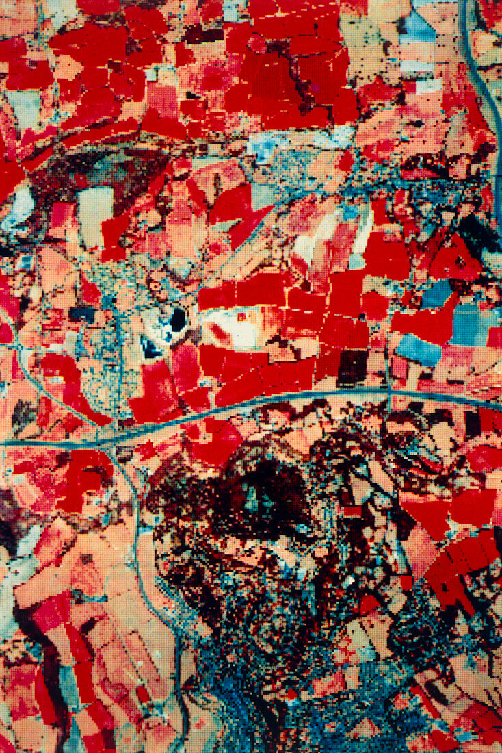
| Simulated image of raw (unprocessed) data due to arrive from the SPOT satellite (a Landsat-type satellite due to be launched by France in November 1985),showing the area around Godstone,Surrey,England. Data was recorded by an airborne scanner & degraded to give the 20x20 metres ground resolution which the SPOT satellite will provide: SPOT is also due to carry a Black & white scanner capable of providing 10x10m ground resolution,showing more detail than existing Landsat images. Healthy vegetation appears red,urban areas blue. Linear features such as roads & railways are visible. Compare with E750/016-019: SPOT simulations of | |
| Lizenzart: | Lizenzpflichtig |
| Credit: | Science Photo Library / Nigel Press Associates |
| Bildgröße: | 3371 px × 5049 px |
| Modell-Rechte: | nicht erforderlich |
| Eigentums-Rechte: | nicht erforderlich |
| Restrictions: | - |
Preise für dieses Bild ab 15 €
Universitäten & Organisationen
(Informationsmaterial Digital, Informationsmaterial Print, Lehrmaterial Digital etc.)
ab 15 €
Redaktionell
(Bücher, Bücher: Sach- und Fachliteratur, Digitale Medien (redaktionell) etc.)
ab 30 €
Werbung
(Anzeigen, Aussenwerbung, Digitale Medien, Fernsehwerbung, Karten, Werbemittel, Zeitschriften etc.)
ab 55 €
Handelsprodukte
(bedruckte Textilie, Kalender, Postkarte, Grußkarte, Verpackung etc.)
ab 75 €
Pauschalpreise
Rechtepakete für die unbeschränkte Bildnutzung in Print oder Online
ab 495 €