Satellite image of land-use in Surrey,England
Bildnummer 11746554
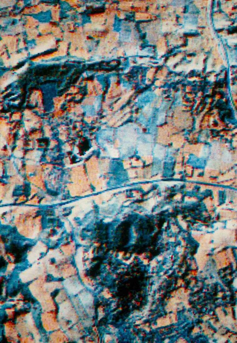
| Landsat TM (thematic mapper) image recorded by the Landsat 4 satellite (launched in July 1982) showing land use around Godstone,Surrey,England. Arrangements of fields are seen; healthy vegetation (which strongly reflects infra-red radiation) appears dull orange in colour. Linear features such as the road which crosses the centre of the image are evident. Compare with E750/016-019: SPOT simulations of same area | |
| Lizenzart: | Lizenzpflichtig |
| Credit: | Science Photo Library / Nigel Press Associates |
| Bildgröße: | 3456 px × 5005 px |
| Modell-Rechte: | nicht erforderlich |
| Eigentums-Rechte: | nicht erforderlich |
| Restrictions: | - |
Preise für dieses Bild ab 15 €
Universitäten & Organisationen
(Informationsmaterial Digital, Informationsmaterial Print, Lehrmaterial Digital etc.)
ab 15 €
Redaktionell
(Bücher, Bücher: Sach- und Fachliteratur, Digitale Medien (redaktionell) etc.)
ab 30 €
Werbung
(Anzeigen, Aussenwerbung, Digitale Medien, Fernsehwerbung, Karten, Werbemittel, Zeitschriften etc.)
ab 55 €
Handelsprodukte
(bedruckte Textilie, Kalender, Postkarte, Grußkarte, Verpackung etc.)
ab 75 €
Pauschalpreise
Rechtepakete für die unbeschränkte Bildnutzung in Print oder Online
ab 495 €