Satellite image of the Strait of Gibraltar
Bildnummer 11746455
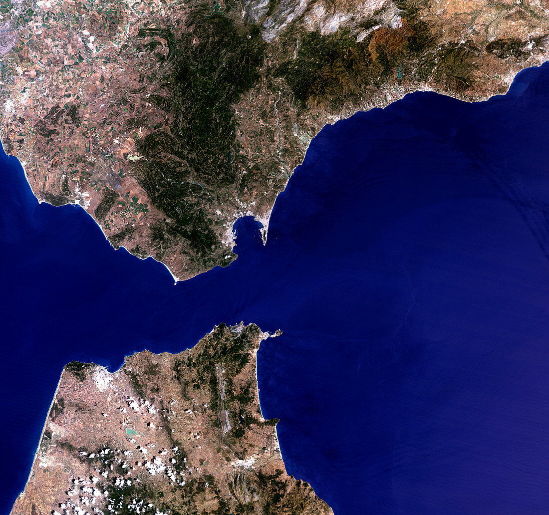
| Strait of Gibraltar. True-colour satellite image of the Strait of Gibraltar,where the Mediterranean Sea (right) meets the Atlantic Ocean (left). North is at top. Water is blue,dense vegetation is green and sparse vegetation is brown,with bare ground and urban areas white. Spain is at upper frame and Morocco is at bottom left. Gibraltar,which is British,is on the peninsula at centre. The city on the other side of the bay from it is Algeciras. The cities of Tangier (lower left) and Ceuta (on the peninsula at lower centre) are also seen. The Strait of Gibraltar is about 16 kilometres wide at its narrowest point | |
| Lizenzart: | Lizenzpflichtig |
| Credit: | Science Photo Library / Planetobserver |
| Bildgröße: | 3300 px × 3095 px |
| Modell-Rechte: | nicht erforderlich |
| Eigentums-Rechte: | nicht erforderlich |
| Restrictions: | - |
Preise für dieses Bild ab 15 €
Universitäten & Organisationen
(Informationsmaterial Digital, Informationsmaterial Print, Lehrmaterial Digital etc.)
ab 15 €
Redaktionell
(Bücher, Bücher: Sach- und Fachliteratur, Digitale Medien (redaktionell) etc.)
ab 30 €
Werbung
(Anzeigen, Aussenwerbung, Digitale Medien, Fernsehwerbung, Karten, Werbemittel, Zeitschriften etc.)
ab 55 €
Handelsprodukte
(bedruckte Textilie, Kalender, Postkarte, Grußkarte, Verpackung etc.)
ab 75 €
Pauschalpreise
Rechtepakete für die unbeschränkte Bildnutzung in Print oder Online
ab 495 €