Satellite image of the Strait of Magellan
Bildnummer 11746454
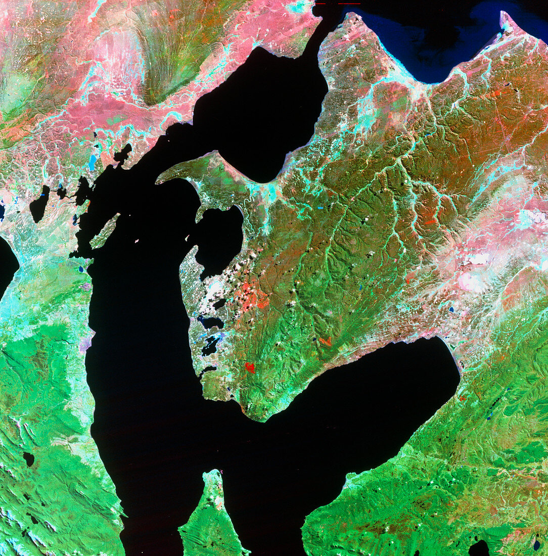
| Strait of Magellan. Satellite image of the Strait of Magellan and the city of Punta Arenas,Chile. North is at top. The colours approximate to natural tones,with bare ground and urban areas having a purple tinge. The white areas are clouds. The Magellan Strait (black) separates the South American mainland (left) from the island of Tierra del Fuego (right). The strait is about 530 kilometres (km) long and 3-24 km wide. Punta Arenas (centre left) is one of the world's most southerly cities. Image taken by the American Landsat satellite in February | |
| Lizenzart: | Lizenzpflichtig |
| Credit: | Science Photo Library / MDA Information Systems |
| Bildgröße: | 5052 px × 5125 px |
| Modell-Rechte: | nicht erforderlich |
| Eigentums-Rechte: | nicht erforderlich |
| Restrictions: | - |
Preise für dieses Bild ab 15 €
Universitäten & Organisationen
(Informationsmaterial Digital, Informationsmaterial Print, Lehrmaterial Digital etc.)
ab 15 €
Redaktionell
(Bücher, Bücher: Sach- und Fachliteratur, Digitale Medien (redaktionell) etc.)
ab 30 €
Werbung
(Anzeigen, Aussenwerbung, Digitale Medien, Fernsehwerbung, Karten, Werbemittel, Zeitschriften etc.)
ab 55 €
Handelsprodukte
(bedruckte Textilie, Kalender, Postkarte, Grußkarte, Verpackung etc.)
ab 75 €
Pauschalpreise
Rechtepakete für die unbeschränkte Bildnutzung in Print oder Online
ab 495 €