Shetland Islands,satellite image
Bildnummer 11746389
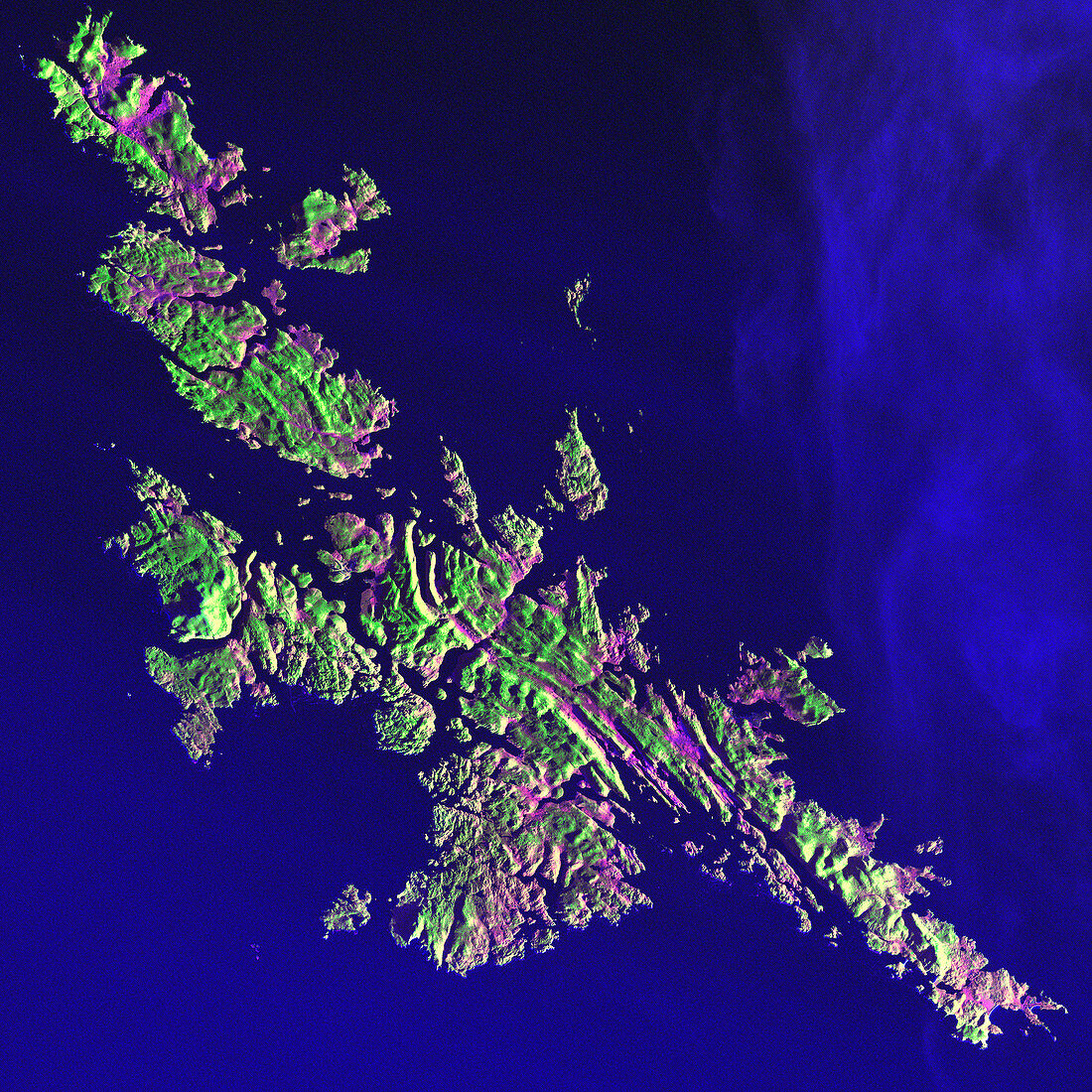
| Shetland Islands,satellite image. North is at upper left. Vegetation varies from pink to green,depending on its moisture content. The landscape is a rugged terrain of hills covered in grass and heather. The Shetland Islands lie 210 kilometres north of the Scottish mainland,in the North Atlantic Ocean. Despite their 60 degrees North latitude,the Shetlands enjoy a relatively temperate climate thanks to the warming influence of the Gulf Stream. Akpatok Island,at roughly the same latitude,is encased in ice at this time of year (see image E205/131). The area shown in this image is around 90 kilometres wide. The image data includes infrared wavelengths,and was obtained on 11 December 2001,by the Landsat 7 satellite | |
| Lizenzart: | Lizenzpflichtig |
| Credit: | Science Photo Library / NASA |
| Bildgröße: | 4800 px × 4800 px |
| Modell-Rechte: | nicht erforderlich |
| Eigentums-Rechte: | nicht erforderlich |
| Restrictions: | - |
Preise für dieses Bild ab 15 €
Universitäten & Organisationen
(Informationsmaterial Digital, Informationsmaterial Print, Lehrmaterial Digital etc.)
ab 15 €
Redaktionell
(Bücher, Bücher: Sach- und Fachliteratur, Digitale Medien (redaktionell) etc.)
ab 30 €
Werbung
(Anzeigen, Aussenwerbung, Digitale Medien, Fernsehwerbung, Karten, Werbemittel, Zeitschriften etc.)
ab 55 €
Handelsprodukte
(bedruckte Textilie, Kalender, Postkarte, Grußkarte, Verpackung etc.)
ab 75 €
Pauschalpreise
Rechtepakete für die unbeschränkte Bildnutzung in Print oder Online
ab 495 €
Keywords
- 2000er Jahre,
- 21. Jahrhundert,
- Atlantisch,
- Atlantischer Ozean,
- britisch,
- Dezember,
- Erdbeobachtung,
- Europa,
- europäisch,
- geografisch,
- Geographie,
- Großbritannien,
- infrarot,
- Insel,
- ir,
- Land,
- Landsat 7,
- Marine,
- Meer,
- Natur,
- Ozean,
- Satellit,
- Satellitenbild,
- schottisch,
- Schottland,
- Umwelt,
- Vegetation,
- Vereinigtes Königreich,
- Wasser,
- Weltall,
- Winter