Hawaiian islands
Bildnummer 11746371
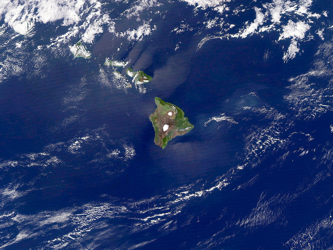
| Hawaiian islands. Satellite image of the islands of the state of Hawaii,USA,in the Pacific Ocean. North is at top. Centre is Big Island,whilst curving left from this are: Maui,Lana'i,Molokai,O'ahu and Kaua'i (twin island). The windward side (north-east) of each island is lusher than that of the leeward sides (south-west). This is due to the larger rainfall,which is brought by the wind. The islands lie on a "hot spot",an unusually hot region of the Earth's mantle. An undersea volcano south east of Big Island may one day create a new island. Image taken on 20 January 2005 | |
| Lizenzart: | Lizenzpflichtig |
| Credit: | Science Photo Library / NASA |
| Bildgröße: | 3840 px × 2880 px |
| Modell-Rechte: | nicht erforderlich |
| Eigentums-Rechte: | nicht erforderlich |
| Restrictions: | - |
Preise für dieses Bild ab 15 €
Universitäten & Organisationen
(Informationsmaterial Digital, Informationsmaterial Print, Lehrmaterial Digital etc.)
ab 15 €
Redaktionell
(Bücher, Bücher: Sach- und Fachliteratur, Digitale Medien (redaktionell) etc.)
ab 30 €
Werbung
(Anzeigen, Aussenwerbung, Digitale Medien, Fernsehwerbung, Karten, Werbemittel, Zeitschriften etc.)
ab 55 €
Handelsprodukte
(bedruckte Textilie, Kalender, Postkarte, Grußkarte, Verpackung etc.)
ab 75 €
Pauschalpreise
Rechtepakete für die unbeschränkte Bildnutzung in Print oder Online
ab 495 €