Big Island,Hawaii
Bildnummer 11746344
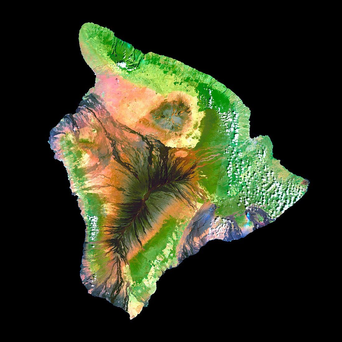
| Big Island,Hawaii,true-colour satellite image. North is at top. Vegetation is green,lava flows are black and clouds are white. Big Island is the largest of the Hawaiian islands. They are entirely volcanic in origin,and Big Island is dominated by the active peak of Mauna Loa volcano (centre) and the dormant Mauna Kea volcano (grey) to its north. Smoke plumes (blue,lower right) rise from Mauna Kilauea volcano,the most active on Earth. Heavy rain and fertile volcanic soil support tropical forests (dark green) and agriculture (light green coastal patches). Image data collected from 1999- 2001 by the Enhanced Thematic Mapper Plus sensor (ETM+) on NASA's Landsat 7 satellite | |
| Lizenzart: | Lizenzpflichtig |
| Credit: | Science Photo Library / NASA |
| Bildgröße: | 4000 px × 4000 px |
| Modell-Rechte: | nicht erforderlich |
| Eigentums-Rechte: | nicht erforderlich |
| Restrictions: | - |
Preise für dieses Bild ab 15 €
Universitäten & Organisationen
(Informationsmaterial Digital, Informationsmaterial Print, Lehrmaterial Digital etc.)
ab 15 €
Redaktionell
(Bücher, Bücher: Sach- und Fachliteratur, Digitale Medien (redaktionell) etc.)
ab 30 €
Werbung
(Anzeigen, Aussenwerbung, Digitale Medien, Fernsehwerbung, Karten, Werbemittel, Zeitschriften etc.)
ab 55 €
Handelsprodukte
(bedruckte Textilie, Kalender, Postkarte, Grußkarte, Verpackung etc.)
ab 75 €
Pauschalpreise
Rechtepakete für die unbeschränkte Bildnutzung in Print oder Online
ab 495 €
Keywords
- 2000,
- Amerika,
- Amerikanisch,
- Anbau,
- Bauernhöfe,
- Berg,
- Bodennutzung,
- etm,
- Felder,
- geografisch,
- Geographie,
- Geologie,
- geologisch,
- Gipfel,
- Große Insel,
- Hawaii,
- hawaiisch,
- Inseln,
- Kilauea,
- kultiviert,
- Landsat 7,
- Landwirtschaft,
- landwirtschaftlich,
- Lavastrom,
- Mauna Kea,
- optisch,
- Pazifik,
- Satellit,
- Sichtbar,
- Umwelt,
- uns,
- USA,
- Vereinigte Staaten,
- Vulkan,
- Vulkane,
- vulkanisch,
- Weltall,
- Wolke,
- Wolken,
- Wolkig