Deforestation,satellite image
Bildnummer 11746218
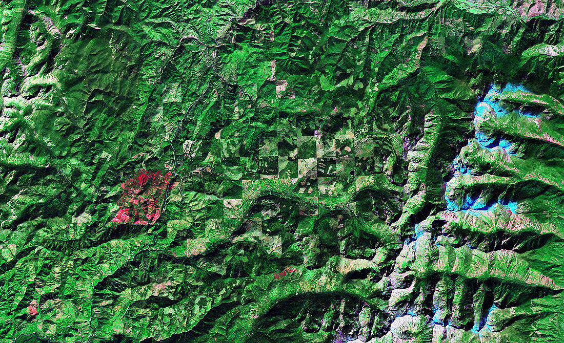
| Deforestation,satellite image. This is Bitterroot Valley,in Montana,USA. The valley is either side of the river running down left,with mountains to far left and right. Vegetation is dark and light green and non-vegetated areas are light brown,blue and red. The deforestation is in the area at centre,and is the light brown areas seen in the regular pattern of squares. This regular pattern is caused by human cultivation in the area,which is also the cause of the deforestation. The story of the environmental degradation in the valley was studied in Collapse: How Societies Choose to Fail or Succeed (Jared Diamond,2005). Image data from NASA's Landsat satellites | |
| Lizenzart: | Lizenzpflichtig |
| Credit: | Science Photo Library / NASA |
| Bildgröße: | 3500 px × 2132 px |
| Modell-Rechte: | nicht erforderlich |
| Eigentums-Rechte: | nicht erforderlich |
| Restrictions: | - |
Preise für dieses Bild ab 15 €
Universitäten & Organisationen
(Informationsmaterial Digital, Informationsmaterial Print, Lehrmaterial Digital etc.)
ab 15 €
Redaktionell
(Bücher, Bücher: Sach- und Fachliteratur, Digitale Medien (redaktionell) etc.)
ab 30 €
Werbung
(Anzeigen, Aussenwerbung, Digitale Medien, Fernsehwerbung, Karten, Werbemittel, Zeitschriften etc.)
ab 55 €
Handelsprodukte
(bedruckte Textilie, Kalender, Postkarte, Grußkarte, Verpackung etc.)
ab 75 €
Pauschalpreise
Rechtepakete für die unbeschränkte Bildnutzung in Print oder Online
ab 495 €
Keywords
- Abholzung,
- Amerikanisch,
- Bauernhof,
- Bauernhöfe,
- Berg,
- Beschädigt,
- Buch,
- Erdbeobachtung,
- Feld,
- Felder,
- Fluss,
- geografisch,
- Geographie,
- Katastrophe,
- Krise,
- ländlich,
- Landschaft,
- Montana,
- Nordamerika,
- nordamerikanisch,
- Ökologie,
- Ökologisch,
- Satellit,
- Satellitenbild,
- Schaden,
- Tal,
- Umwelt,
- uns,
- USA,
- Vegetation,
- Vereinigte Staaten,
- Wald,
- Weltall,
- Zusammenbruch