Deforestation
Bildnummer 11746041
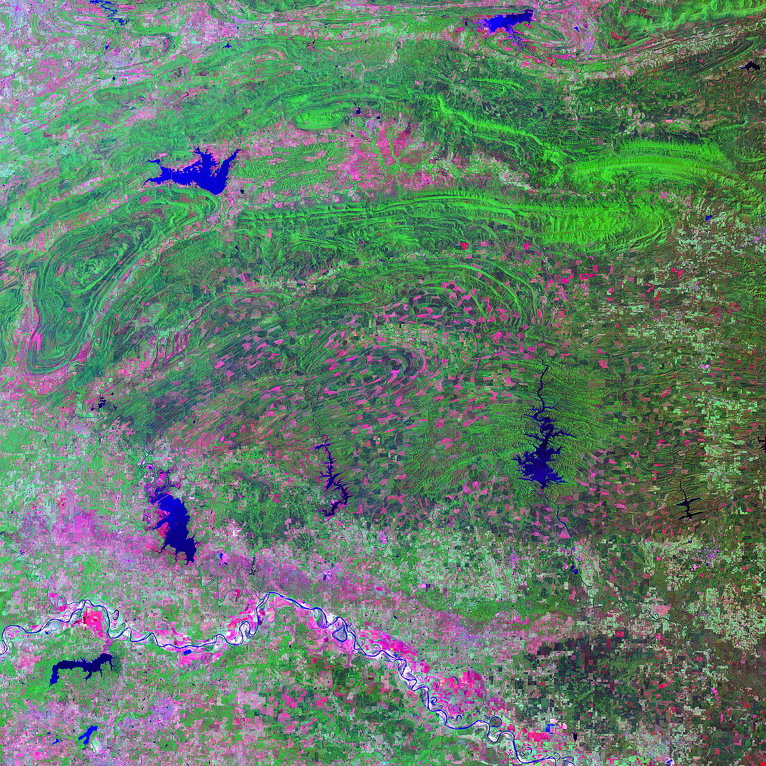
| Deforestation. Coloured optical and infrared,Landsat satellite image of south-eastern Oklahoma,USA. North is at top. Water is blue,vegetation is green and barren areas are pink. Forests cover the Ouachita Mountains,whose folds are seen running across the upper and centre frame. Clear-cut areas of these forests are seen as dark pink patches. The boundary between Oklahoma and Texas is marked by the Red River,the white-bounded blue line that meanders over the lower frame and is lined with agricultural fields (pink and green). Many of the river meanders have been cut from the main river,forming oxbow lakes (blue,crescent-shaped) | |
| Lizenzart: | Lizenzpflichtig |
| Credit: | Science Photo Library / MDA Information Systems |
| Bildgröße: | 4180 px × 4180 px |
| Modell-Rechte: | nicht erforderlich |
| Eigentums-Rechte: | nicht erforderlich |
| Restrictions: | - |
Preise für dieses Bild ab 15 €
Universitäten & Organisationen
(Informationsmaterial Digital, Informationsmaterial Print, Lehrmaterial Digital etc.)
ab 15 €
Redaktionell
(Bücher, Bücher: Sach- und Fachliteratur, Digitale Medien (redaktionell) etc.)
ab 30 €
Werbung
(Anzeigen, Aussenwerbung, Digitale Medien, Fernsehwerbung, Karten, Werbemittel, Zeitschriften etc.)
ab 55 €
Handelsprodukte
(bedruckte Textilie, Kalender, Postkarte, Grußkarte, Verpackung etc.)
ab 75 €
Pauschalpreise
Rechtepakete für die unbeschränkte Bildnutzung in Print oder Online
ab 495 €