Deforestation
Bildnummer 11746033
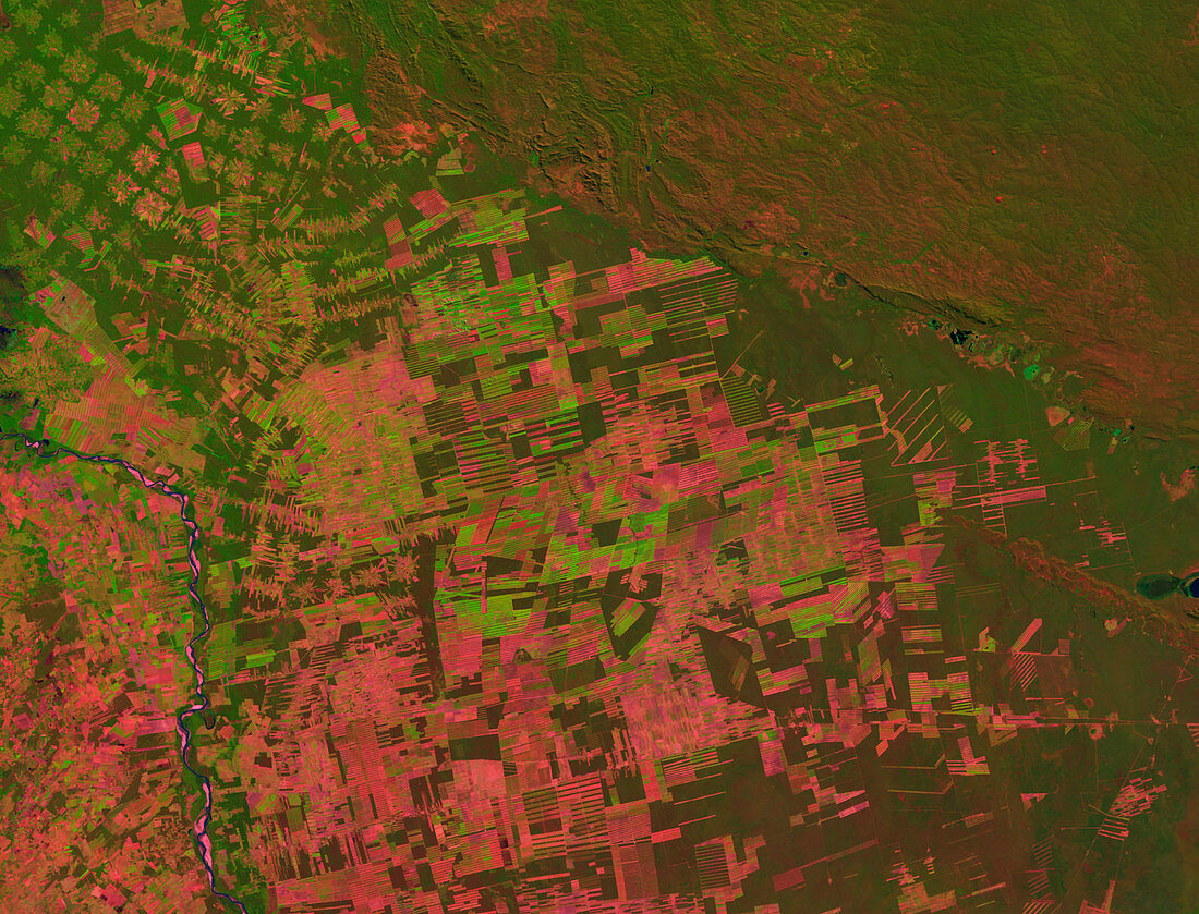
| Deforestation (image 2 of 2). Coloured satellite image of the deforestation near the Bolivian city of Santa Cruz (lower left) in 1998. North is at top. Forest and other vegetation is green,with bare ground red. Santa Cruz lies to the west of the Piray River (dark blue). To the east of the river,much of the land has been deforested for agriculture. This image was produced by the Thematic Mapper on an American Landsat satellite. Image area: 240x320 kilometres. For the deforestation in 1984 see image E640/438 | |
| Lizenzart: | Lizenzpflichtig |
| Credit: | Science Photo Library / NASA's Goddard Space Flight Center |
| Bildgröße: | 2517 px × 1919 px |
| Modell-Rechte: | nicht erforderlich |
| Eigentums-Rechte: | nicht erforderlich |
| Restrictions: | - |
Preise für dieses Bild ab 15 €
Universitäten & Organisationen
(Informationsmaterial Digital, Informationsmaterial Print, Lehrmaterial Digital etc.)
ab 15 €
Redaktionell
(Bücher, Bücher: Sach- und Fachliteratur, Digitale Medien (redaktionell) etc.)
ab 30 €
Werbung
(Anzeigen, Aussenwerbung, Digitale Medien, Fernsehwerbung, Karten, Werbemittel, Zeitschriften etc.)
ab 55 €
Handelsprodukte
(bedruckte Textilie, Kalender, Postkarte, Grußkarte, Verpackung etc.)
ab 75 €
Pauschalpreise
Rechtepakete für die unbeschränkte Bildnutzung in Print oder Online
ab 495 €