Coloured radar satellite image of deforestation
Bildnummer 11745994
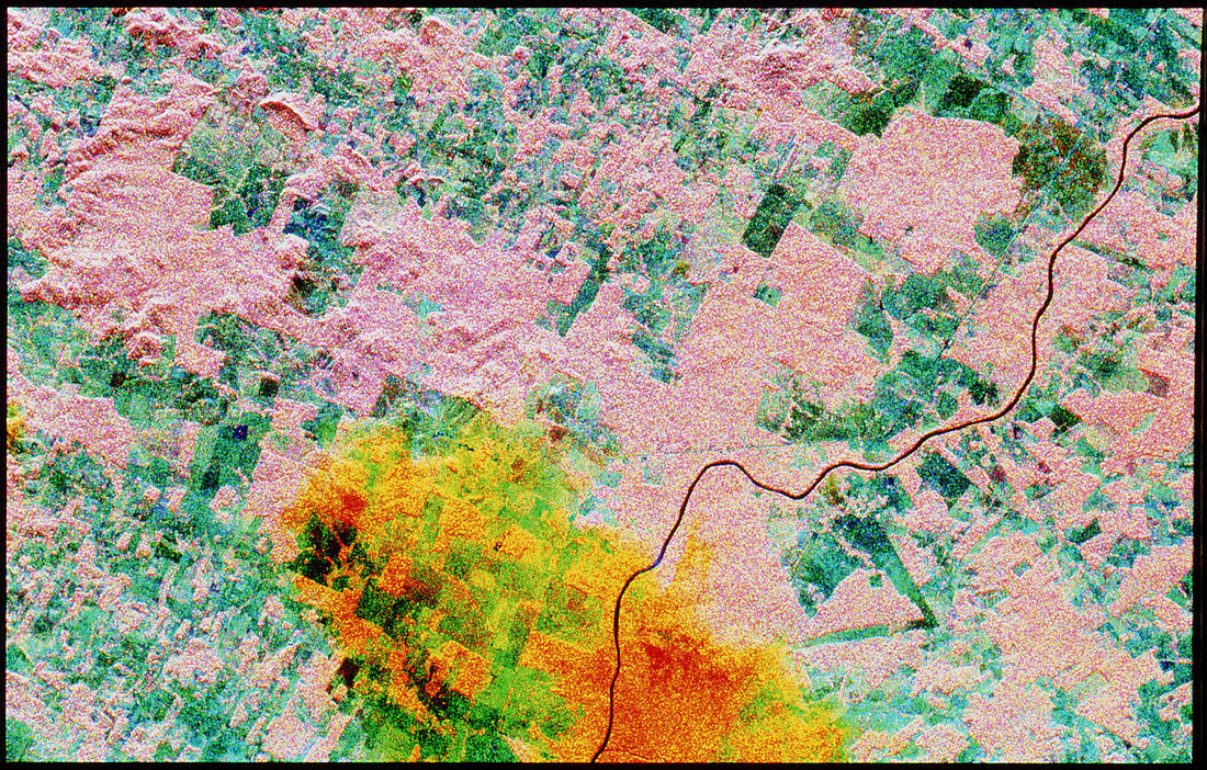
| Deforestation. Coloured radar satellite image of areas of rainforest cleared for agriculture. North is at upper left. Untouched forest is pink,areas cleared for agriculture are blue and green and a rainstorm appears orange at bottom centre. The heavy rainfall in tropical regions means that cleared land rapidly has its nutrients leached away. This leads farmers to clear more forest to maintain productivity,causing habitat loss for countless species of rainforest animals & plants. Image taken by the Spaceborne Imaging Radar-C aboard the American space shuttle Endeavour in April over the state of Rondonia,western Brazil. Image area: 35.2km x 21.3km | |
| Lizenzart: | Lizenzpflichtig |
| Credit: | Science Photo Library / NASA |
| Bildgröße: | 4736 px × 3024 px |
| Modell-Rechte: | nicht erforderlich |
| Eigentums-Rechte: | nicht erforderlich |
| Restrictions: | - |
Preise für dieses Bild ab 15 €
Universitäten & Organisationen
(Informationsmaterial Digital, Informationsmaterial Print, Lehrmaterial Digital etc.)
ab 15 €
Redaktionell
(Bücher, Bücher: Sach- und Fachliteratur, Digitale Medien (redaktionell) etc.)
ab 30 €
Werbung
(Anzeigen, Aussenwerbung, Digitale Medien, Fernsehwerbung, Karten, Werbemittel, Zeitschriften etc.)
ab 55 €
Handelsprodukte
(bedruckte Textilie, Kalender, Postkarte, Grußkarte, Verpackung etc.)
ab 75 €
Pauschalpreise
Rechtepakete für die unbeschränkte Bildnutzung in Print oder Online
ab 495 €