ERS-1 radar image showing deforestation in Brazil
Bildnummer 11745981
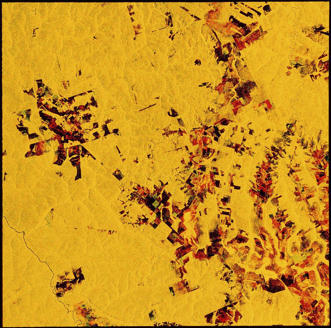
| Amazon deforestation. Multitemporal radar image showing deforestation in the Diamantina area of Brazil. The image was made by combining two frames taken on different days. The large rectangular patches are fields caused by 'slash and burn' clearing by cattle farmers. The colours within these dark areas reflect the changes to surface cover as grass grows; growth of grass in the month between the two frames being acquired is shown as green,whilst land burnt between the two frames is red. Land previously cleared but with no new growth is seen as black. The data for this image were gathered by the ERS-1 European radar mapping satellite | |
| Lizenzart: | Lizenzpflichtig |
| Credit: | Science Photo Library / ESA, EURIMAGE |
| Bildgröße: | 3769 px × 3738 px |
| Modell-Rechte: | nicht erforderlich |
| Eigentums-Rechte: | nicht erforderlich |
| Restrictions: |
|
Preise für dieses Bild ab 15 €
Universitäten & Organisationen
(Informationsmaterial Digital, Informationsmaterial Print, Lehrmaterial Digital etc.)
ab 15 €
Redaktionell
(Bücher, Bücher: Sach- und Fachliteratur, Digitale Medien (redaktionell) etc.)
ab 30 €
Werbung
(Anzeigen, Aussenwerbung, Digitale Medien, Fernsehwerbung, Karten, Werbemittel, Zeitschriften etc.)
ab 55 €
Handelsprodukte
(bedruckte Textilie, Kalender, Postkarte, Grußkarte, Verpackung etc.)
ab 75 €
Pauschalpreise
Rechtepakete für die unbeschränkte Bildnutzung in Print oder Online
ab 495 €