Lost city of Ubar,radar and optical images
Bildnummer 11745913
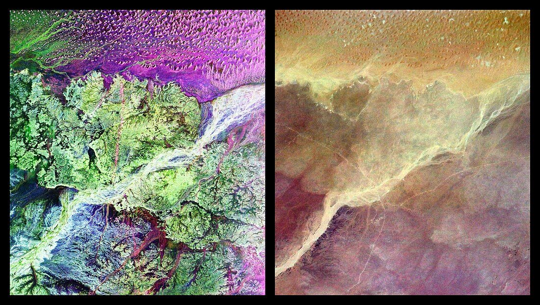
| Lost city of Ubar. Radar image (left) and enhanced optical image (right) of the desert region around the lost city of Ubar,southern Oman. In the radar image the purple area is a large field of sand dunes,whilst the green area is the rough limestone rocks of the desert floor. The white diagonal streak is a wadi (dry stream). The fortress of the lost city is near the wadi at centre. The radar data for this image were gathered by the SIR-C radar instrument and the optical image was taken by shuttle astronauts,both aboard Shuttle Mission STS-59 on 13 April 1994 | |
| Lizenzart: | Lizenzpflichtig |
| Credit: | Science Photo Library / NASA |
| Bildgröße: | 3210 px × 1815 px |
| Modell-Rechte: | nicht erforderlich |
| Eigentums-Rechte: | nicht erforderlich |
| Restrictions: | - |
Preise für dieses Bild ab 15 €
Universitäten & Organisationen
(Informationsmaterial Digital, Informationsmaterial Print, Lehrmaterial Digital etc.)
ab 15 €
Redaktionell
(Bücher, Bücher: Sach- und Fachliteratur, Digitale Medien (redaktionell) etc.)
ab 30 €
Werbung
(Anzeigen, Aussenwerbung, Digitale Medien, Fernsehwerbung, Karten, Werbemittel, Zeitschriften etc.)
ab 55 €
Handelsprodukte
(bedruckte Textilie, Kalender, Postkarte, Grußkarte, Verpackung etc.)
ab 75 €
Pauschalpreise
Rechtepakete für die unbeschränkte Bildnutzung in Print oder Online
ab 495 €
Keywords
- 1990er Jahre,
- 20. Jahrhundert,
- alte Stadt,
- Arabien,
- Arabische Halbinsel,
- Archäologie,
- Astronautenfotografie,
- Duo,
- Erdbeobachtung,
- Festung,
- Geographie,
- Geologie,
- geologisch,
- Geschichte,
- historisch,
- Leer,
- Mitte,
- Oman,
- optisch,
- Osten,
- Paar,
- Sanddüne,
- Space Shuttle,
- Spur,
- Spuren,
- Umwelt,
- verbessert,
- verlorene Stadt,
- Weltall,
- Wüste,
- Zwei