Wildfire scars,satellite image
Bildnummer 11745884
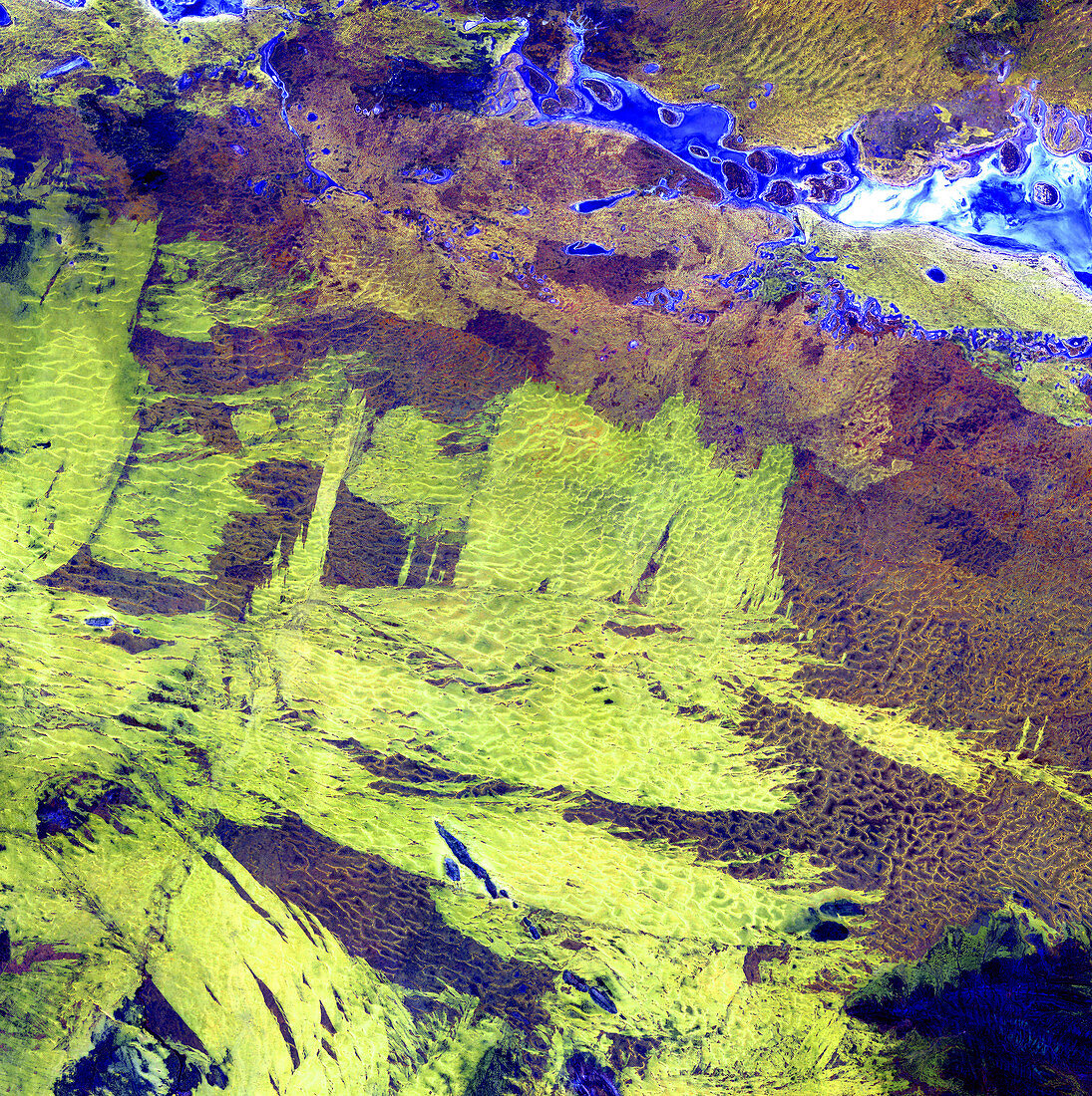
| Wildfire scars,satellite image. North is at top. This is the area around Lake Amadeus (blue/white,upper right),an ephemeral salt lake in the arid outback of Australia's Northern Territory. Areas of scrub have been cleared by wildfires,leaving bare sandy areas (green/yellow). Salt deposits are white,and moister areas are blue. The rippled patterns seen are sand dunes formed by the prevailing winds. This area is in the south-west of the Northern Territory. The area shown in this image is around 60 kilometres wide. The image data includes infrared wavelengths,and was obtained on 3 January 2003,using the ASTER sensor on the Terra satellite | |
| Lizenzart: | Lizenzpflichtig |
| Credit: | Science Photo Library / NASA |
| Bildgröße: | 4800 px × 4821 px |
| Modell-Rechte: | nicht erforderlich |
| Eigentums-Rechte: | nicht erforderlich |
| Restrictions: | - |
Preise für dieses Bild ab 15 €
Universitäten & Organisationen
(Informationsmaterial Digital, Informationsmaterial Print, Lehrmaterial Digital etc.)
ab 15 €
Redaktionell
(Bücher, Bücher: Sach- und Fachliteratur, Digitale Medien (redaktionell) etc.)
ab 30 €
Werbung
(Anzeigen, Aussenwerbung, Digitale Medien, Fernsehwerbung, Karten, Werbemittel, Zeitschriften etc.)
ab 55 €
Handelsprodukte
(bedruckte Textilie, Kalender, Postkarte, Grußkarte, Verpackung etc.)
ab 75 €
Pauschalpreise
Rechtepakete für die unbeschränkte Bildnutzung in Print oder Online
ab 495 €
Keywords
- 2000er Jahre,
- 21. Jahrhundert,
- Aster,
- Australien,
- australisch,
- Eintags-,
- Erdbeobachtung,
- Felsig,
- geografisch,
- Geographie,
- heiß,
- infrarot,
- ir,
- Januar,
- Land,
- Narbe,
- Natur,
- Reflexionsradiometer,
- saisonal,
- Salzig,
- sandig,
- Satellit,
- Satellitenbild,
- Sommer,
- Terra,
- trocken,
- Umwelt,
- Vegetation,
- Weltall,
- Wüste