Dry river beds,satellite image
Bildnummer 11745883
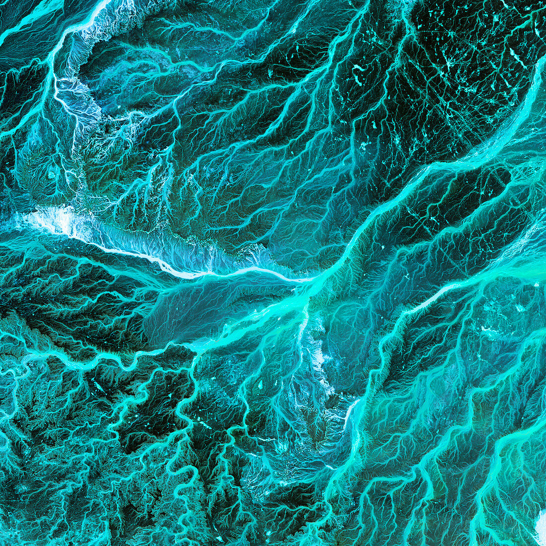
| Dry river beds,satellite image. North is at top. The bright blue areas are meandering wadis (dry river beds) that have formed in this desert area due to flooding. Desert areas can go for years without rain,and then be flooded by large storms. The floodwaters briefly carve patterns in the landscape and then evaporate or sink into the soil. The bright blue areas have higher moisture content than the surrounding areas. This area is in eastern Jordan,near the Syrian border. The area shown in this image is around 60 kilometres wide. The image data includes infrared wavelengths,and was obtained on 17 May 2001,using the ASTER sensor on the Terra satellite | |
| Lizenzart: | Lizenzpflichtig |
| Credit: | Science Photo Library / NASA |
| Bildgröße: | 4800 px × 4800 px |
| Modell-Rechte: | nicht erforderlich |
| Eigentums-Rechte: | nicht erforderlich |
| Restrictions: | - |
Preise für dieses Bild ab 15 €
Universitäten & Organisationen
(Informationsmaterial Digital, Informationsmaterial Print, Lehrmaterial Digital etc.)
ab 15 €
Redaktionell
(Bücher, Bücher: Sach- und Fachliteratur, Digitale Medien (redaktionell) etc.)
ab 30 €
Werbung
(Anzeigen, Aussenwerbung, Digitale Medien, Fernsehwerbung, Karten, Werbemittel, Zeitschriften etc.)
ab 55 €
Handelsprodukte
(bedruckte Textilie, Kalender, Postkarte, Grußkarte, Verpackung etc.)
ab 75 €
Pauschalpreise
Rechtepakete für die unbeschränkte Bildnutzung in Print oder Online
ab 495 €
Keywords
- 2000er Jahre,
- 21. Jahrhundert,
- Asiatisch,
- Asien,
- Aster,
- Blütezeit,
- Erdbeobachtung,
- Erdkunde,
- Felsig,
- geografisch,
- Geographie,
- Grün,
- Hagedorn,
- heiß,
- Hydrologie,
- infrarot,
- ir,
- Jordanien,
- Land,
- Mittlerer Osten,
- Nahost,
- Natur,
- Reflexionsradiometer,
- sandig,
- Satellit,
- Satellitenbild,
- Terra,
- trocken,
- Umwelt,
- Weltall,
- Wüste