Atacama Desert,satellite image
Bildnummer 11745880
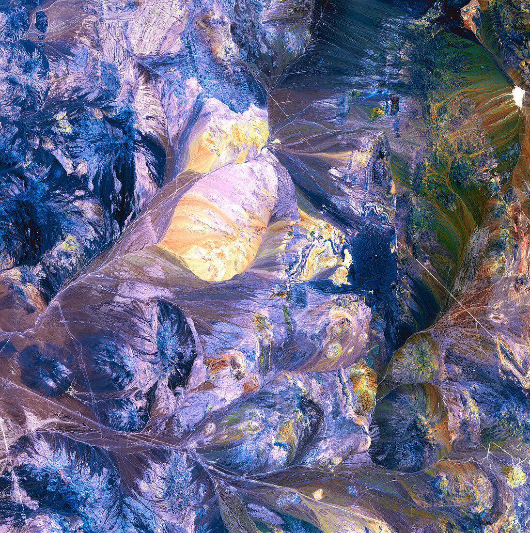
| Atacama Desert,satellite image. North is at top. This area of the Atacama Desert is a mountainous area where the desert merges with the foothills of the Andes. A large sandy area (yellow) is at upper left. The various colours show mineral sediments and salt deposits in this region of salt pans,canyons and mountains. This area of the Atacama Desert,the world's driest desert,is in northern Chile. The area shown in this image is around 60 kilometres wide. The image data includes infrared wavelengths,and was obtained on 28 October 2001,using the ASTER sensor on the Terra satellite | |
| Lizenzart: | Lizenzpflichtig |
| Credit: | Science Photo Library / NASA |
| Bildgröße: | 4800 px × 4827 px |
| Modell-Rechte: | nicht erforderlich |
| Eigentums-Rechte: | nicht erforderlich |
| Restrictions: | - |
Preise für dieses Bild ab 15 €
Universitäten & Organisationen
(Informationsmaterial Digital, Informationsmaterial Print, Lehrmaterial Digital etc.)
ab 15 €
Redaktionell
(Bücher, Bücher: Sach- und Fachliteratur, Digitale Medien (redaktionell) etc.)
ab 30 €
Werbung
(Anzeigen, Aussenwerbung, Digitale Medien, Fernsehwerbung, Karten, Werbemittel, Zeitschriften etc.)
ab 55 €
Handelsprodukte
(bedruckte Textilie, Kalender, Postkarte, Grußkarte, Verpackung etc.)
ab 75 €
Pauschalpreise
Rechtepakete für die unbeschränkte Bildnutzung in Print oder Online
ab 495 €
Keywords
- 2000er Jahre,
- 21. Jahrhundert,
- Anden,
- Aster,
- Atacamawüste,
- Berg,
- Chile,
- Chilenisch,
- Erdbeobachtung,
- Erdkunde,
- Felsig,
- geografisch,
- Geographie,
- Geologie,
- geologisch,
- heiß,
- infrarot,
- ir,
- Land,
- montan,
- Natur,
- Oktober,
- Reflexionsradiometer,
- Salzig,
- sandig,
- Satellit,
- Satellitenbild,
- Südamerika,
- Südamerikanisch,
- Terra,
- trocken,
- Umwelt,
- Vulkan,
- vulkanisch,
- Vulkanologie,
- Weltall,
- Wüste