Landsat photo of part of Namibia
Bildnummer 11745768
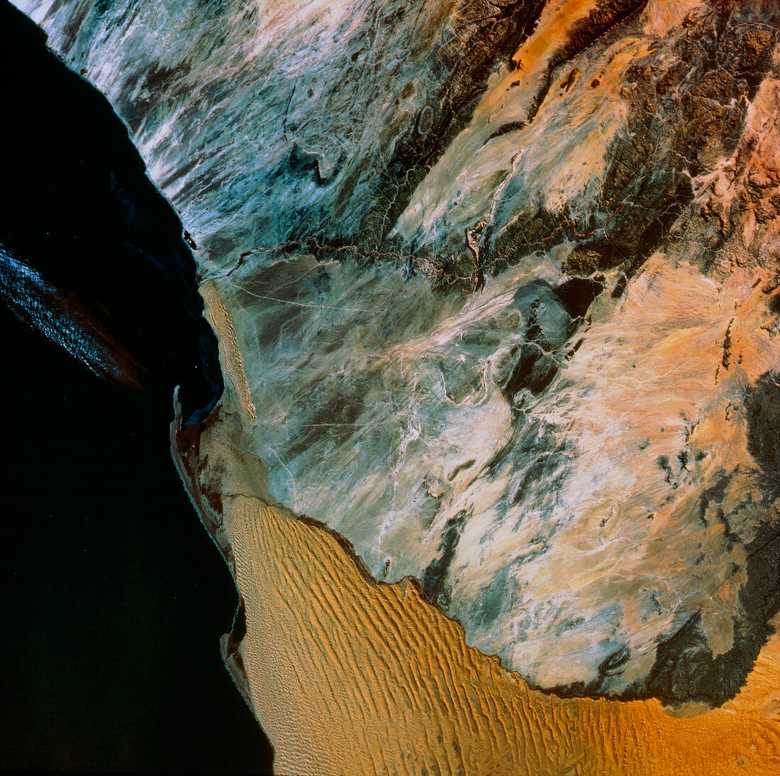
| Natural-colour Landsat satellite image of part of Namibia,Africa. This image clearly demonstrates the boundary between the two types of terrain in the Namib Desert: the sandy desert of the south (bottom) and the rocky desert of the north. The boundary is the seasonal Kuiseb River. A small oval feature,ringed with pale grey,may be seen just below top centre. This is Rossing,site of the world's largest uranium deposit. The orange- tinted terrain toward top right is part of the Khomas Highland | |
| Lizenzart: | Lizenzpflichtig |
| Credit: | Science Photo Library / MDA Information Systems |
| Bildgröße: | 4989 px × 4958 px |
| Modell-Rechte: | nicht erforderlich |
| Eigentums-Rechte: | nicht erforderlich |
| Restrictions: | - |
Preise für dieses Bild ab 15 €
Universitäten & Organisationen
(Informationsmaterial Digital, Informationsmaterial Print, Lehrmaterial Digital etc.)
ab 15 €
Redaktionell
(Bücher, Bücher: Sach- und Fachliteratur, Digitale Medien (redaktionell) etc.)
ab 30 €
Werbung
(Anzeigen, Aussenwerbung, Digitale Medien, Fernsehwerbung, Karten, Werbemittel, Zeitschriften etc.)
ab 55 €
Handelsprodukte
(bedruckte Textilie, Kalender, Postkarte, Grußkarte, Verpackung etc.)
ab 75 €
Pauschalpreise
Rechtepakete für die unbeschränkte Bildnutzung in Print oder Online
ab 495 €