Aral Sea,satellite image,2000
Bildnummer 11745536
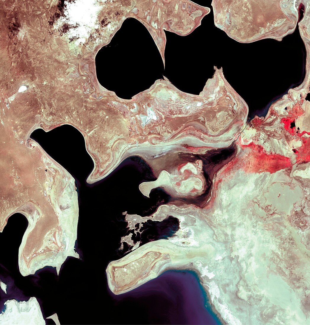
| Aral Sea,satellite image. Image 3 of 3. North is at top. This inland lake is found between Uzbekistan (west) and Kazakhstan (east) and used to be the fourth largest lake in the world. Since the 1960s,it has lost more than half of its volume. This is due to overuse of the feeder rivers (the Syr Darya and Amu Darya) in irrigation of cotton and paddy fields. Image taken by Landsat's multispectral scanner instrument on 29th July 2000. For a series showing the lake's progressive shrinkage,see images E590/289 - E590/291 | |
| Lizenzart: | Lizenzpflichtig |
| Credit: | Science Photo Library / NASA |
| Bildgröße: | 4118 px × 4323 px |
| Modell-Rechte: | nicht erforderlich |
| Eigentums-Rechte: | nicht erforderlich |
| Restrictions: | - |
Preise für dieses Bild ab 15 €
Universitäten & Organisationen
(Informationsmaterial Digital, Informationsmaterial Print, Lehrmaterial Digital etc.)
ab 15 €
Redaktionell
(Bücher, Bücher: Sach- und Fachliteratur, Digitale Medien (redaktionell) etc.)
ab 30 €
Werbung
(Anzeigen, Aussenwerbung, Digitale Medien, Fernsehwerbung, Karten, Werbemittel, Zeitschriften etc.)
ab 55 €
Handelsprodukte
(bedruckte Textilie, Kalender, Postkarte, Grußkarte, Verpackung etc.)
ab 75 €
Pauschalpreise
Rechtepakete für die unbeschränkte Bildnutzung in Print oder Online
ab 495 €
Keywords
- 2000,
- 21. Jahrhundert,
- Aralsee,
- Asiatisch,
- Asien,
- Austrocknen,
- Drainage,
- Dürre,
- Erdbeobachtung,
- geografisch,
- Geographie,
- Industrie,
- Industriell,
- Inland,
- Juli,
- Kasachstan,
- Land,
- Meer,
- Salz,
- Salzig,
- Satellit,
- Satellitenbild,
- Sediment,
- See,
- trocken,
- Trocknen,
- Umwelt,
- Weltall,
- Wüste