Lake Gairdner,Australia
Bildnummer 11745443
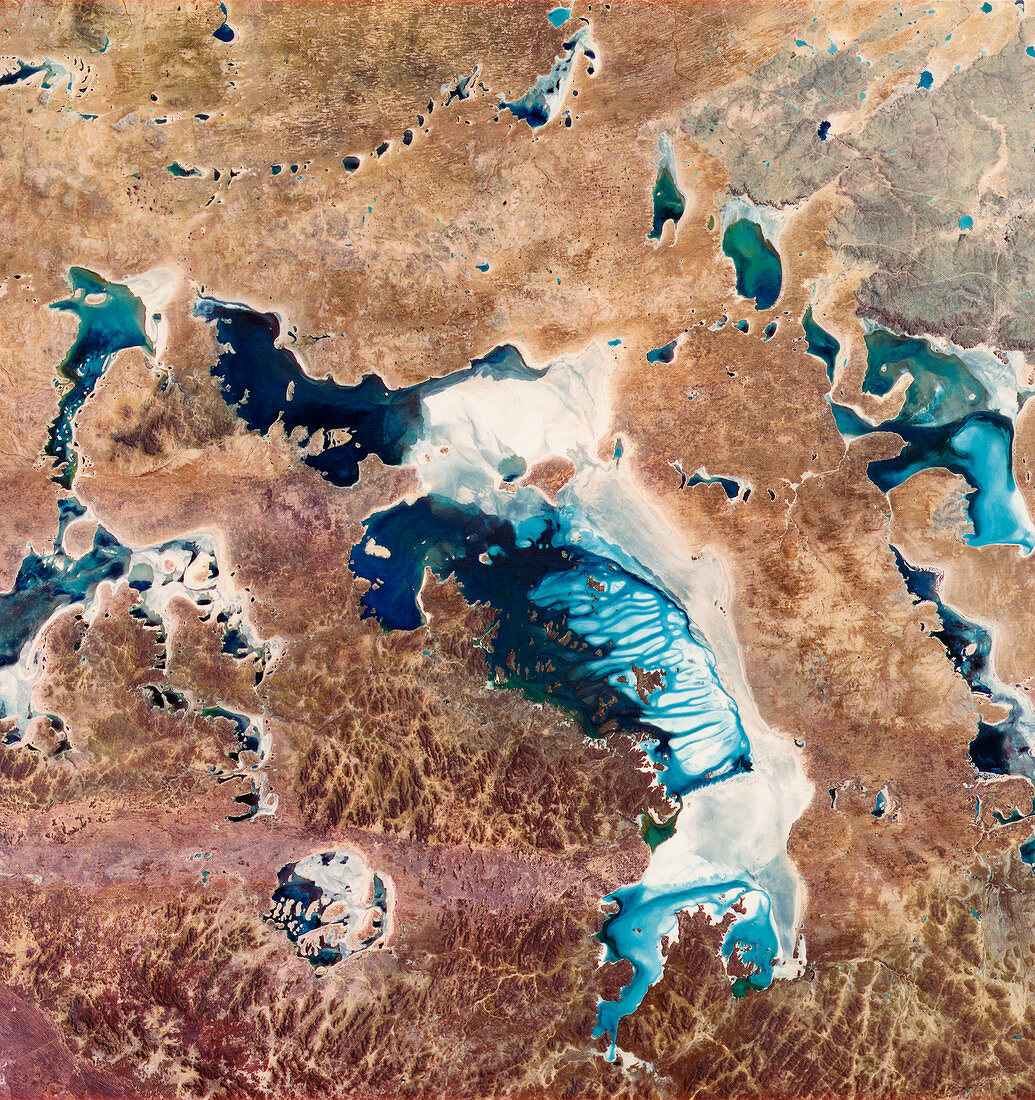
| Lake Gairdner,Australia,infrared satellite image. North is at top. Water (blue) is flooding this usually arid area (brown) in South Australia. Salt deposits (white) are left behind as the water evaporates. Lake Gairdner (the large central lake,running from upper left to lower right) is around 4500 square kilometres in area. It is an ephemeral lake,a lake that only fills with water following heavy rains. It is a salt flat during dry years. This 180-kilometre-wide image was taken on 15 February 1973,in visible and infrared wavelengths,with the Multispectral Scanner (MSS) sensor on NASA's Landsat 1 satellite | |
| Lizenzart: | Lizenzpflichtig |
| Credit: | Science Photo Library / MDA Information Systems |
| Bildgröße: | 4060 px × 4314 px |
| Modell-Rechte: | nicht erforderlich |
| Eigentums-Rechte: | nicht erforderlich |
| Restrictions: | - |
Preise für dieses Bild ab 15 €
Universitäten & Organisationen
(Informationsmaterial Digital, Informationsmaterial Print, Lehrmaterial Digital etc.)
ab 15 €
Redaktionell
(Bücher, Bücher: Sach- und Fachliteratur, Digitale Medien (redaktionell) etc.)
ab 30 €
Werbung
(Anzeigen, Aussenwerbung, Digitale Medien, Fernsehwerbung, Karten, Werbemittel, Zeitschriften etc.)
ab 55 €
Handelsprodukte
(bedruckte Textilie, Kalender, Postkarte, Grußkarte, Verpackung etc.)
ab 75 €
Pauschalpreise
Rechtepakete für die unbeschränkte Bildnutzung in Print oder Online
ab 495 €