Lakes Erie and Ontario
Bildnummer 11745439
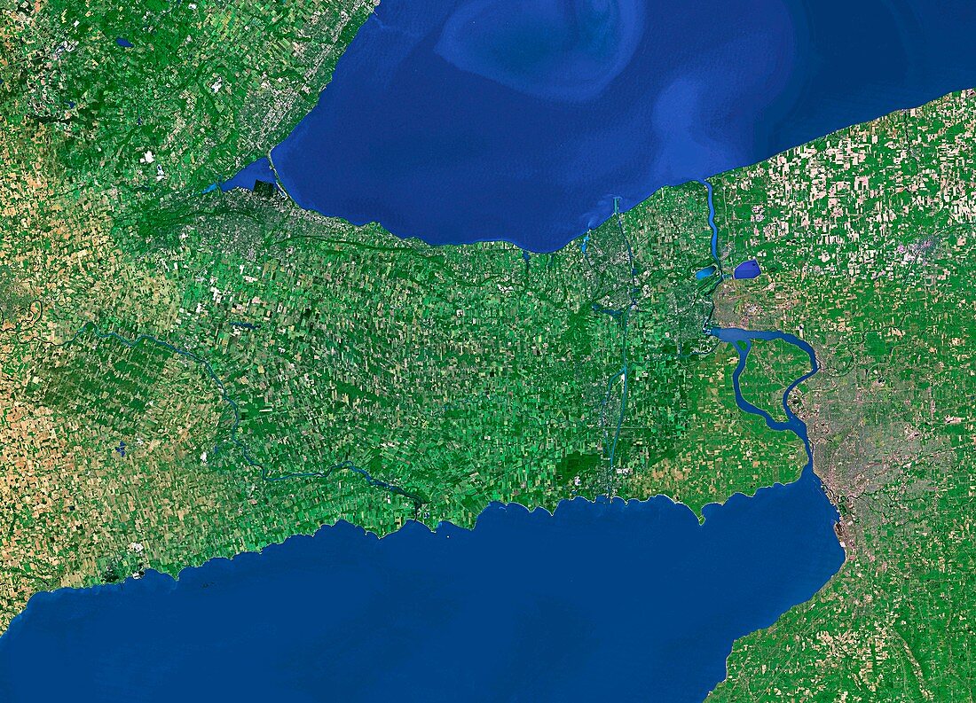
| Lakes Erie and Ontario. Satellite image of part of two of the Great Lakes,Ontario (upper) and Erie (lower). The lakes are linked by the Niagara river,at centre right. This river contains Niagara Falls,a large complex of waterfalls. The Niagara river forms part of the border between the Canadian province of Ontario (to the left) and the state of New York,USA (to the right). The brown patch at centre right is the city of Buffalo | |
| Lizenzart: | Lizenzpflichtig |
| Credit: | Science Photo Library / Worldsat International |
| Bildgröße: | 5600 px × 4035 px |
| Modell-Rechte: | nicht erforderlich |
| Eigentums-Rechte: | nicht erforderlich |
| Restrictions: |
|
Preise für dieses Bild ab 15 €
Universitäten & Organisationen
(Informationsmaterial Digital, Informationsmaterial Print, Lehrmaterial Digital etc.)
ab 15 €
Redaktionell
(Bücher, Bücher: Sach- und Fachliteratur, Digitale Medien (redaktionell) etc.)
ab 30 €
Werbung
(Anzeigen, Aussenwerbung, Digitale Medien, Fernsehwerbung, Karten, Werbemittel, Zeitschriften etc.)
ab 55 €
Handelsprodukte
(bedruckte Textilie, Kalender, Postkarte, Grußkarte, Verpackung etc.)
ab 75 €
Pauschalpreise
Rechtepakete für die unbeschränkte Bildnutzung in Print oder Online
ab 495 €