Lake Carnegie,Australia
Bildnummer 11745435
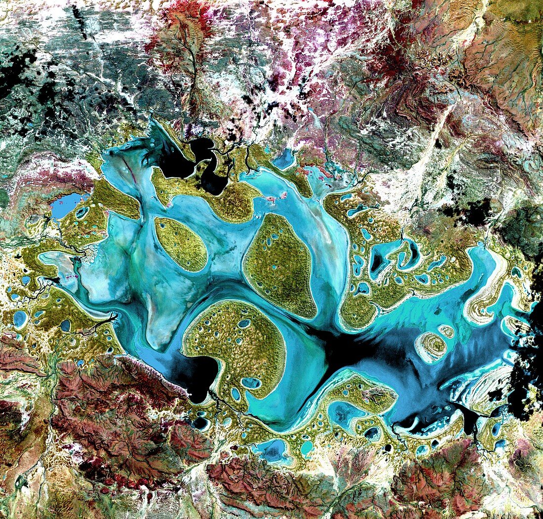
| Lake Carnegie,Australia,satellite image. Water (blue) is seen flooding this normally arid area in Western Australia. This is the western end of Lake Carnegie,an ephemeral lake that fills with water only after heavy rains,being reduced to a muddy marsh during dry years. The image is around 50 kilometres wide. Image acquired in visible and infrared wavelengths on 19 May 1999 by the Enhanced Thematic Mapper Plus (ETM+) sensor on NASA's Landsat 7 satellite | |
| Lizenzart: | Lizenzpflichtig |
| Credit: | Science Photo Library / NASA |
| Bildgröße: | 2146 px × 2050 px |
| Modell-Rechte: | nicht erforderlich |
| Eigentums-Rechte: | nicht erforderlich |
| Restrictions: | - |
Preise für dieses Bild ab 15 €
Universitäten & Organisationen
(Informationsmaterial Digital, Informationsmaterial Print, Lehrmaterial Digital etc.)
ab 15 €
Redaktionell
(Bücher, Bücher: Sach- und Fachliteratur, Digitale Medien (redaktionell) etc.)
ab 30 €
Werbung
(Anzeigen, Aussenwerbung, Digitale Medien, Fernsehwerbung, Karten, Werbemittel, Zeitschriften etc.)
ab 55 €
Handelsprodukte
(bedruckte Textilie, Kalender, Postkarte, Grußkarte, Verpackung etc.)
ab 75 €
Pauschalpreise
Rechtepakete für die unbeschränkte Bildnutzung in Print oder Online
ab 495 €