Infrared satellite image of the Caspian Sea
Bildnummer 11745422
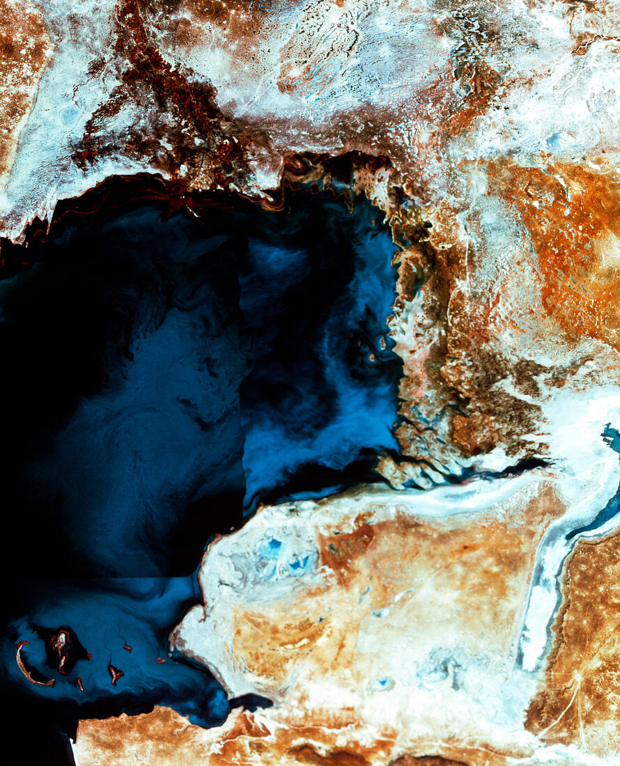
| Caspian Sea. Infrared satellite image of the northern part of the Caspian Sea and surrounding salt flats. North is at top. In the infrared range water is dark blue/black,bare ground is brown,salt flats are white/grey,and green vegetation is red. Salt flats occur in previously submerged areas. The Caspian Sea is the world's largest inland sea and has no outflows; water is lost only by evaporation. This evaporation leaves behind salts that were dissolved in the water. These form salt flats as sea level changes from year to year | |
| Lizenzart: | Lizenzpflichtig |
| Credit: | Science Photo Library / MDA Information Systems |
| Bildgröße: | 2866 px × 3543 px |
| Modell-Rechte: | nicht erforderlich |
| Eigentums-Rechte: | nicht erforderlich |
| Restrictions: | - |
Preise für dieses Bild ab 15 €
Universitäten & Organisationen
(Informationsmaterial Digital, Informationsmaterial Print, Lehrmaterial Digital etc.)
ab 15 €
Redaktionell
(Bücher, Bücher: Sach- und Fachliteratur, Digitale Medien (redaktionell) etc.)
ab 30 €
Werbung
(Anzeigen, Aussenwerbung, Digitale Medien, Fernsehwerbung, Karten, Werbemittel, Zeitschriften etc.)
ab 55 €
Handelsprodukte
(bedruckte Textilie, Kalender, Postkarte, Grußkarte, Verpackung etc.)
ab 75 €
Pauschalpreise
Rechtepakete für die unbeschränkte Bildnutzung in Print oder Online
ab 495 €