True-colour satellite image of the Panama Canal
Bildnummer 11745157
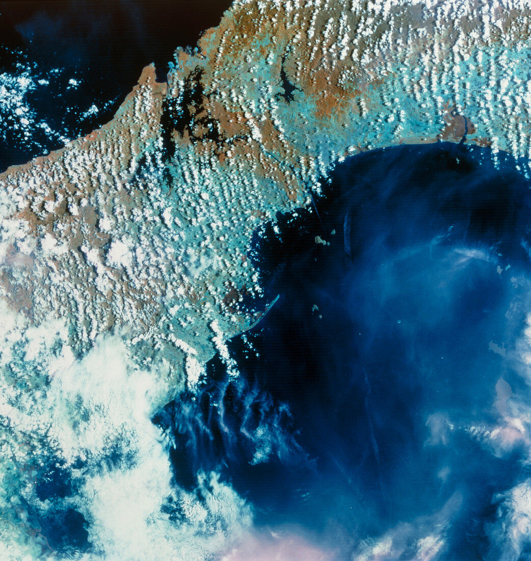
| Panama Canal. True-colour satellite image of the Panama Canal (at upper centre). North is at top. The canal links the Caribbean Sea (top left) with the Pacific (bottom right). Gatun lake (at upper left) is the highest point on the canal,being 26 metres above sea level. Ships are raised and lowered by a series of locks at either end of the canal. At the north end of the canal is the city of Colon whilst Panama City lies at the southern end. The Panama Canal is 64 km (40 miles) long. It was constructed during 1906-14 under the direction of American engineer George Goethals. Image taken in April | |
| Lizenzart: | Lizenzpflichtig |
| Credit: | Science Photo Library / MDA Information Systems |
| Bildgröße: | 4503 px × 4755 px |
| Modell-Rechte: | nicht erforderlich |
| Eigentums-Rechte: | nicht erforderlich |
| Restrictions: | - |
Preise für dieses Bild ab 15 €
Universitäten & Organisationen
(Informationsmaterial Digital, Informationsmaterial Print, Lehrmaterial Digital etc.)
ab 15 €
Redaktionell
(Bücher, Bücher: Sach- und Fachliteratur, Digitale Medien (redaktionell) etc.)
ab 30 €
Werbung
(Anzeigen, Aussenwerbung, Digitale Medien, Fernsehwerbung, Karten, Werbemittel, Zeitschriften etc.)
ab 55 €
Handelsprodukte
(bedruckte Textilie, Kalender, Postkarte, Grußkarte, Verpackung etc.)
ab 75 €
Pauschalpreise
Rechtepakete für die unbeschränkte Bildnutzung in Print oder Online
ab 495 €