Infrared satellite image of Suez canal & Nile dlta
Bildnummer 11745154
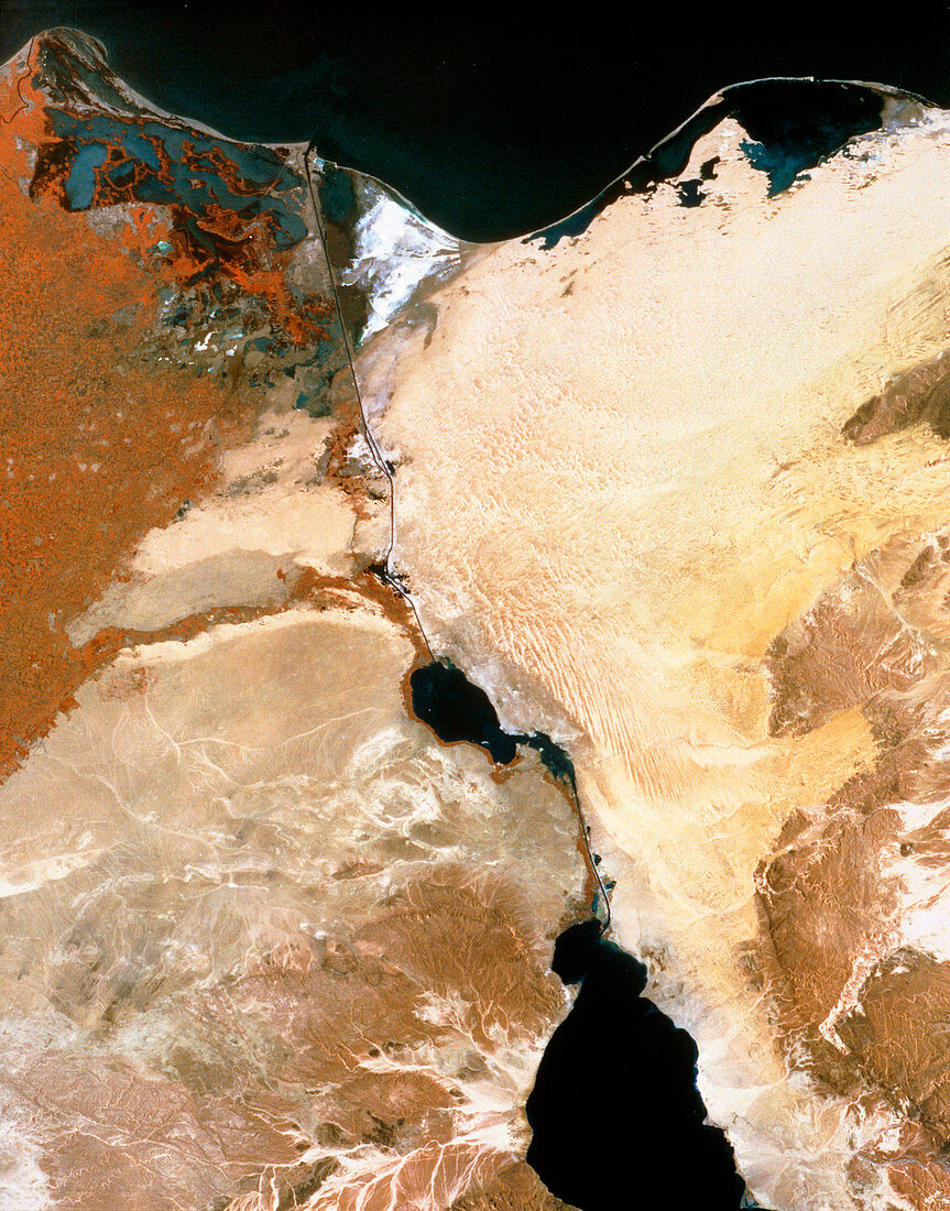
| Suez Canal. Infrared satellite image of the Suez canal (at centre),Egypt,with parts of the Nile Delta (at left) and Sinai peninsula (at right). North is at top. In the infrared range water appears black,barren areas are yellow & brown,buildings are grey and green vegetation is red. The Suez canal links the Red (at bottom centre) and Mediterranean (at top) seas. At the north end of the canal is Port Said and at the south end is Suez. The canal passes through the salty Great Bitter Lake (at lower centre). The canal provides the fastest route between Europe and Asia. Image taken by the American Landsat satellite | |
| Lizenzart: | Lizenzpflichtig |
| Credit: | Science Photo Library / MDA Information Systems |
| Bildgröße: | 3785 px × 4824 px |
| Modell-Rechte: | nicht erforderlich |
| Eigentums-Rechte: | nicht erforderlich |
| Restrictions: | - |
Preise für dieses Bild ab 15 €
Universitäten & Organisationen
(Informationsmaterial Digital, Informationsmaterial Print, Lehrmaterial Digital etc.)
ab 15 €
Redaktionell
(Bücher, Bücher: Sach- und Fachliteratur, Digitale Medien (redaktionell) etc.)
ab 30 €
Werbung
(Anzeigen, Aussenwerbung, Digitale Medien, Fernsehwerbung, Karten, Werbemittel, Zeitschriften etc.)
ab 55 €
Handelsprodukte
(bedruckte Textilie, Kalender, Postkarte, Grußkarte, Verpackung etc.)
ab 75 €
Pauschalpreise
Rechtepakete für die unbeschränkte Bildnutzung in Print oder Online
ab 495 €