Volga Delta,satellite image
Bildnummer 11745143
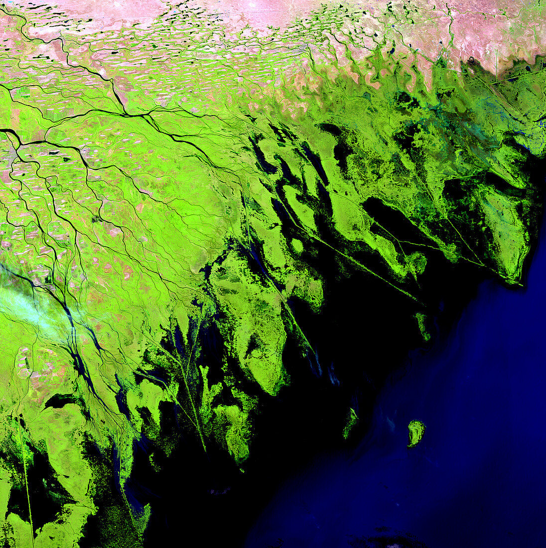
| Volga Delta,satellite image. North is at top. Vegetation on delta sediment is green,water is black,and more barren areas (salt flats,across top) are pink. This is the eastern part of the Volga Delta,an extensive set of deposits and hundreds of water channels where the Volga River flows into the Caspian Sea. The delta sustains the most productive fishing grounds in Eurasia. The salt flats have been formed by the drying of the Caspian Sea,accompanied by an increase in the size of the Volga Delta. The area shown in this image is around 100 kilometres wide. The image data includes infrared wavelengths,and was obtained on 29 August 1999,by the Landsat 7 satellite | |
| Lizenzart: | Lizenzpflichtig |
| Credit: | Science Photo Library / NASA |
| Bildgröße: | 4800 px × 4816 px |
| Modell-Rechte: | nicht erforderlich |
| Eigentums-Rechte: | nicht erforderlich |
| Restrictions: | - |
Preise für dieses Bild ab 15 €
Universitäten & Organisationen
(Informationsmaterial Digital, Informationsmaterial Print, Lehrmaterial Digital etc.)
ab 15 €
Redaktionell
(Bücher, Bücher: Sach- und Fachliteratur, Digitale Medien (redaktionell) etc.)
ab 30 €
Werbung
(Anzeigen, Aussenwerbung, Digitale Medien, Fernsehwerbung, Karten, Werbemittel, Zeitschriften etc.)
ab 55 €
Handelsprodukte
(bedruckte Textilie, Kalender, Postkarte, Grußkarte, Verpackung etc.)
ab 75 €
Pauschalpreise
Rechtepakete für die unbeschränkte Bildnutzung in Print oder Online
ab 495 €
Keywords
- 1900er Jahre,
- 1990er Jahre,
- 20. Jahrhundert,
- Asiatisch,
- Asien,
- August,
- Delta,
- Einlagen,
- Erdbeobachtung,
- Erdkunde,
- Europa,
- europäisch,
- Fluss,
- Fruchtbar,
- geografisch,
- Geographie,
- Hydrologie,
- infrarot,
- ir,
- Kanal,
- Kanäle,
- Kaspisches Meer,
- Küste,
- Küsten-,
- Küstenlinie,
- Land,
- Landsat 7,
- Meer,
- Natur,
- Russisch,
- Russland,
- Satellit,
- Satellitenbild,
- Sediment,
- Sommer,
- Umwelt,
- Vegetation,
- Wasser,
- Wasserstraßen,
- Wasserweg,
- Weltall