True-colour satellite image of the Nile Delta
Bildnummer 11745100
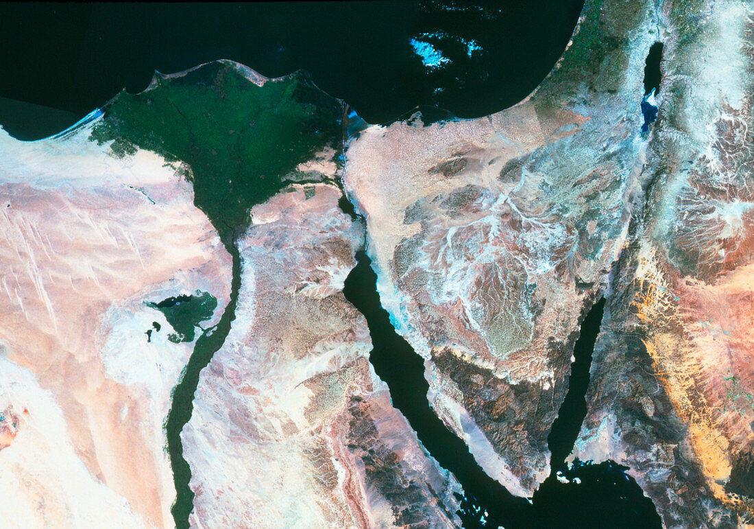
| Nile delta. True-colour satellite image of Egypt showing the Nile Delta. North is at top. Agricult- ure (green) is seen in the fertile delta (upper left) and beside the Nile river (lower left). Bare ground is brown and grey,while water is black. The city of Cairo is the dark grey area at the base of the delta. The Suez Canal (upper centre) connects the Mediterranean Sea (upper left) to the Red Sea (lower right). The Sinai is the triangular body of land at centre right,with the Dead Sea in Israel at top right. Deltas form due to rivers depositing their sediment as they reach the sea. This image is from an American Landsat satellite | |
| Lizenzart: | Lizenzpflichtig |
| Credit: | Science Photo Library / MDA Information Systems |
| Bildgröße: | 3570 px × 2503 px |
| Modell-Rechte: | nicht erforderlich |
| Eigentums-Rechte: | nicht erforderlich |
| Restrictions: | - |
Preise für dieses Bild ab 15 €
Universitäten & Organisationen
(Informationsmaterial Digital, Informationsmaterial Print, Lehrmaterial Digital etc.)
ab 15 €
Redaktionell
(Bücher, Bücher: Sach- und Fachliteratur, Digitale Medien (redaktionell) etc.)
ab 30 €
Werbung
(Anzeigen, Aussenwerbung, Digitale Medien, Fernsehwerbung, Karten, Werbemittel, Zeitschriften etc.)
ab 55 €
Handelsprodukte
(bedruckte Textilie, Kalender, Postkarte, Grußkarte, Verpackung etc.)
ab 75 €
Pauschalpreise
Rechtepakete für die unbeschränkte Bildnutzung in Print oder Online
ab 495 €
Keywords
- Delta,
- Geographie,
- Kairo,
- Nil,
- Rotes Meer,
- Sinai,
- Umwelt,
- Weltall