Landsat mosaic of river Nile and Delta
Bildnummer 11745091
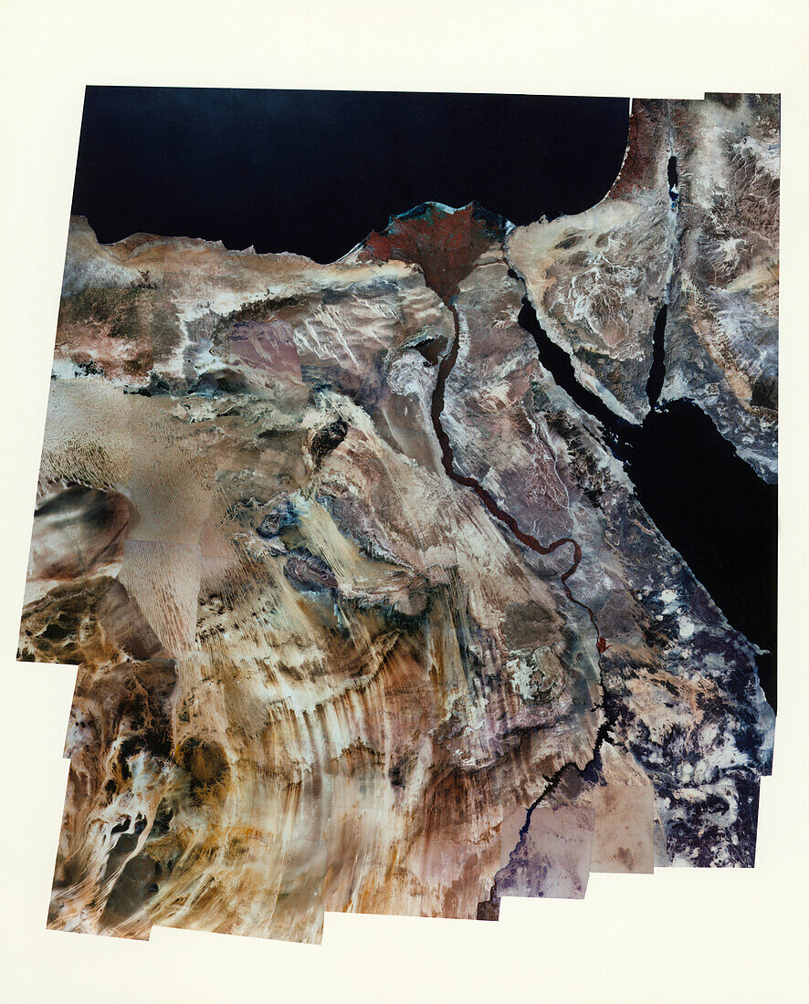
| Landsat mosaic of the River Nile & delta,in the United Arab Republic,or Egypt. The river is the fine black line surrounded by a veneer of vegetation appearing red. The city of Cairo (grey/blue) lies at the start of the delta where the river divides into two branches & heads to the Mediterranean Sea. Beyond the fertile banks of the Nile is barren desert. To the right is the Sinai peninsula with the Gulf of Suez narrowing into the Suez Canal (left) and the Gulf of Arabia (right). These both empty into the Red Sea at centre bottom. The black lozenge,top right,is the Dead Sea; Saudi Arabia is at far right | |
| Lizenzart: | Lizenzpflichtig |
| Credit: | Science Photo Library / MDA Information Systems |
| Bildgröße: | 3042 px × 3775 px |
| Modell-Rechte: | nicht erforderlich |
| Eigentums-Rechte: | nicht erforderlich |
| Restrictions: | - |
Preise für dieses Bild ab 15 €
Universitäten & Organisationen
(Informationsmaterial Digital, Informationsmaterial Print, Lehrmaterial Digital etc.)
ab 15 €
Redaktionell
(Bücher, Bücher: Sach- und Fachliteratur, Digitale Medien (redaktionell) etc.)
ab 30 €
Werbung
(Anzeigen, Aussenwerbung, Digitale Medien, Fernsehwerbung, Karten, Werbemittel, Zeitschriften etc.)
ab 55 €
Handelsprodukte
(bedruckte Textilie, Kalender, Postkarte, Grußkarte, Verpackung etc.)
ab 75 €
Pauschalpreise
Rechtepakete für die unbeschränkte Bildnutzung in Print oder Online
ab 495 €