Nile delta
Bildnummer 11745088
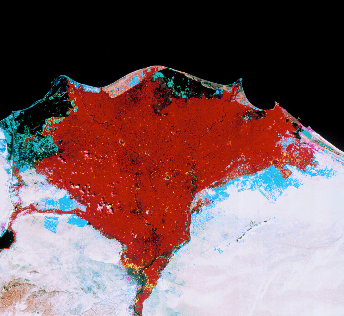
| Nile delta. Colour-enhanced satellite image of the Nile delta,Egypt,showing changes in land use between 1972/73 and 1989/90. The large red area is agricultural land existing in 1972/73. Cyan areas denote new agricultural land claimed from the desert. The large green areas near the coast are lagoons and wetlands which have been partially reclaimed. A few magenta areas show where urban develpoment has encroached on the desert. Just above bottom centre is the grey patch of Cairo,the yellow fringe denoting agricultural land given over for urban development. The data for this image were gathered by Landsat satellites | |
| Lizenzart: | Lizenzpflichtig |
| Credit: | Science Photo Library / MDA Information Systems |
| Bildgröße: | 3259 px × 2988 px |
| Modell-Rechte: | nicht erforderlich |
| Eigentums-Rechte: | nicht erforderlich |
| Restrictions: | - |
Preise für dieses Bild ab 15 €
Universitäten & Organisationen
(Informationsmaterial Digital, Informationsmaterial Print, Lehrmaterial Digital etc.)
ab 15 €
Redaktionell
(Bücher, Bücher: Sach- und Fachliteratur, Digitale Medien (redaktionell) etc.)
ab 30 €
Werbung
(Anzeigen, Aussenwerbung, Digitale Medien, Fernsehwerbung, Karten, Werbemittel, Zeitschriften etc.)
ab 55 €
Handelsprodukte
(bedruckte Textilie, Kalender, Postkarte, Grußkarte, Verpackung etc.)
ab 75 €
Pauschalpreise
Rechtepakete für die unbeschränkte Bildnutzung in Print oder Online
ab 495 €