Amazon Basin,satellite image
Bildnummer 11744978
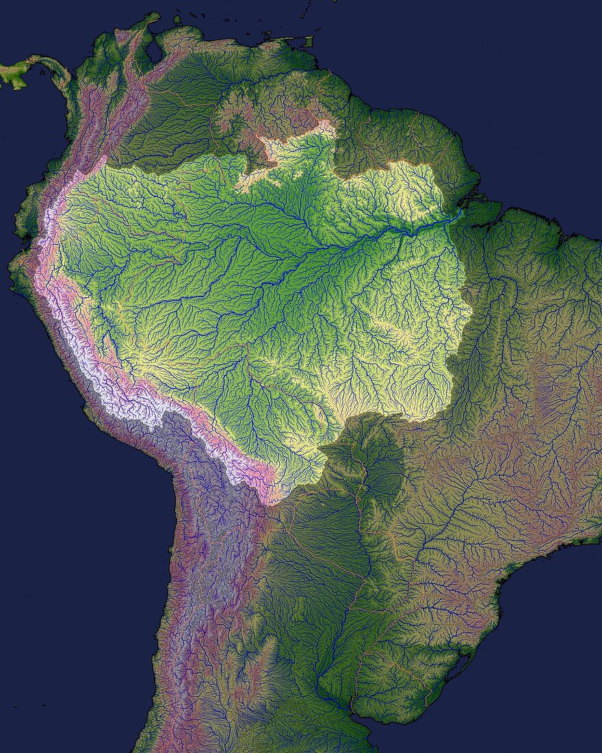
| Amazon Basin. Satellite image of the Amazon Basin (highlighted area) in northern South America. North is at top. Water is blue,and land is colour-coded according to elevation above sea level: dark green (sea level),pink (2000 metres),and white (4500 metres). The Amazon Basin,over 7 million square kilometres in area,is the drainage basin of the Amazon River and is the largest in the world. The source of the Amazon lies high in the Andes mountain (down left). The waters drain eastward through the vast Amazon Rainforest,emerging at the mouth of the Amazon (upper right). In 2007,a new source for the Amazon was reported in southern Peru,which would make the Amazon the world's longest river. This image combines Shuttle Radar Topography Data and HydroSHEDS river data | |
| Lizenzart: | Lizenzpflichtig |
| Credit: | Science Photo Library / NASA |
| Bildgröße: | 4800 px × 6000 px |
| Modell-Rechte: | nicht erforderlich |
| Eigentums-Rechte: | nicht erforderlich |
| Restrictions: | - |
Preise für dieses Bild ab 15 €
Universitäten & Organisationen
(Informationsmaterial Digital, Informationsmaterial Print, Lehrmaterial Digital etc.)
ab 15 €
Redaktionell
(Bücher, Bücher: Sach- und Fachliteratur, Digitale Medien (redaktionell) etc.)
ab 30 €
Werbung
(Anzeigen, Aussenwerbung, Digitale Medien, Fernsehwerbung, Karten, Werbemittel, Zeitschriften etc.)
ab 55 €
Handelsprodukte
(bedruckte Textilie, Kalender, Postkarte, Grußkarte, Verpackung etc.)
ab 75 €
Pauschalpreise
Rechtepakete für die unbeschränkte Bildnutzung in Print oder Online
ab 495 €