Island on the Zambezi river
Bildnummer 11744970
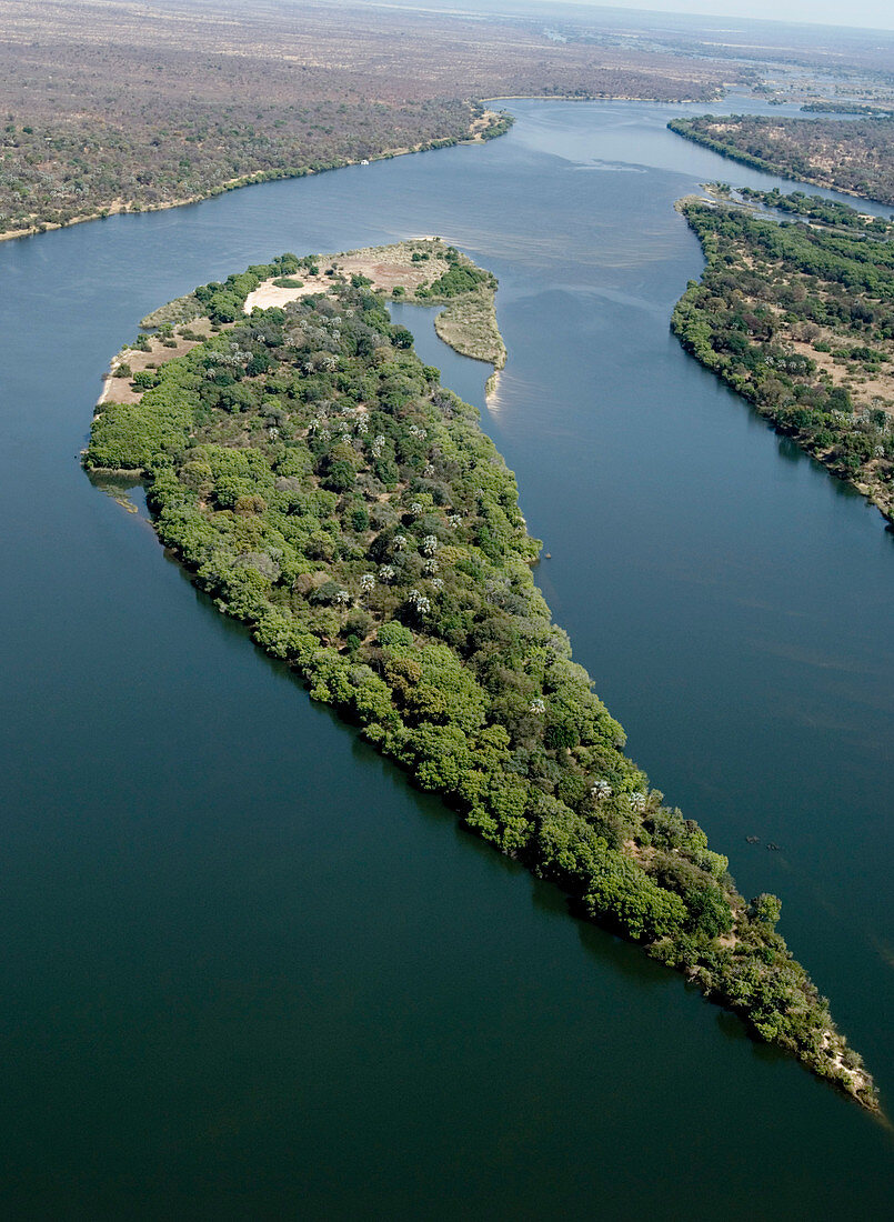
| Island on the Zambezi river,aerial photograph. This island is upstream from Victoria Falls. Zimbabwe is the land on the left (south) riverbank and Zambia is on the right (north). The Zambezi rises in northwest Zambia and flows for 2574 kilometres before emptying into the Indian Ocean in Mozambique. Photographed during the dry season,October,2006 | |
| Lizenzart: | Lizenzpflichtig |
| Credit: | Science Photo Library / Camacho, Tony |
| Bildgröße: | 2848 px × 3890 px |
| Modell-Rechte: | nicht erforderlich |
| Eigentums-Rechte: | nicht erforderlich |
| Restrictions: | - |
Preise für dieses Bild ab 15 €
Universitäten & Organisationen
(Informationsmaterial Digital, Informationsmaterial Print, Lehrmaterial Digital etc.)
ab 15 €
Redaktionell
(Bücher, Bücher: Sach- und Fachliteratur, Digitale Medien (redaktionell) etc.)
ab 30 €
Werbung
(Anzeigen, Aussenwerbung, Digitale Medien, Fernsehwerbung, Karten, Werbemittel, Zeitschriften etc.)
ab 55 €
Handelsprodukte
(bedruckte Textilie, Kalender, Postkarte, Grußkarte, Verpackung etc.)
ab 75 €
Pauschalpreise
Rechtepakete für die unbeschränkte Bildnutzung in Print oder Online
ab 495 €