Saharan desert rivers,satellite image
Bildnummer 11744962
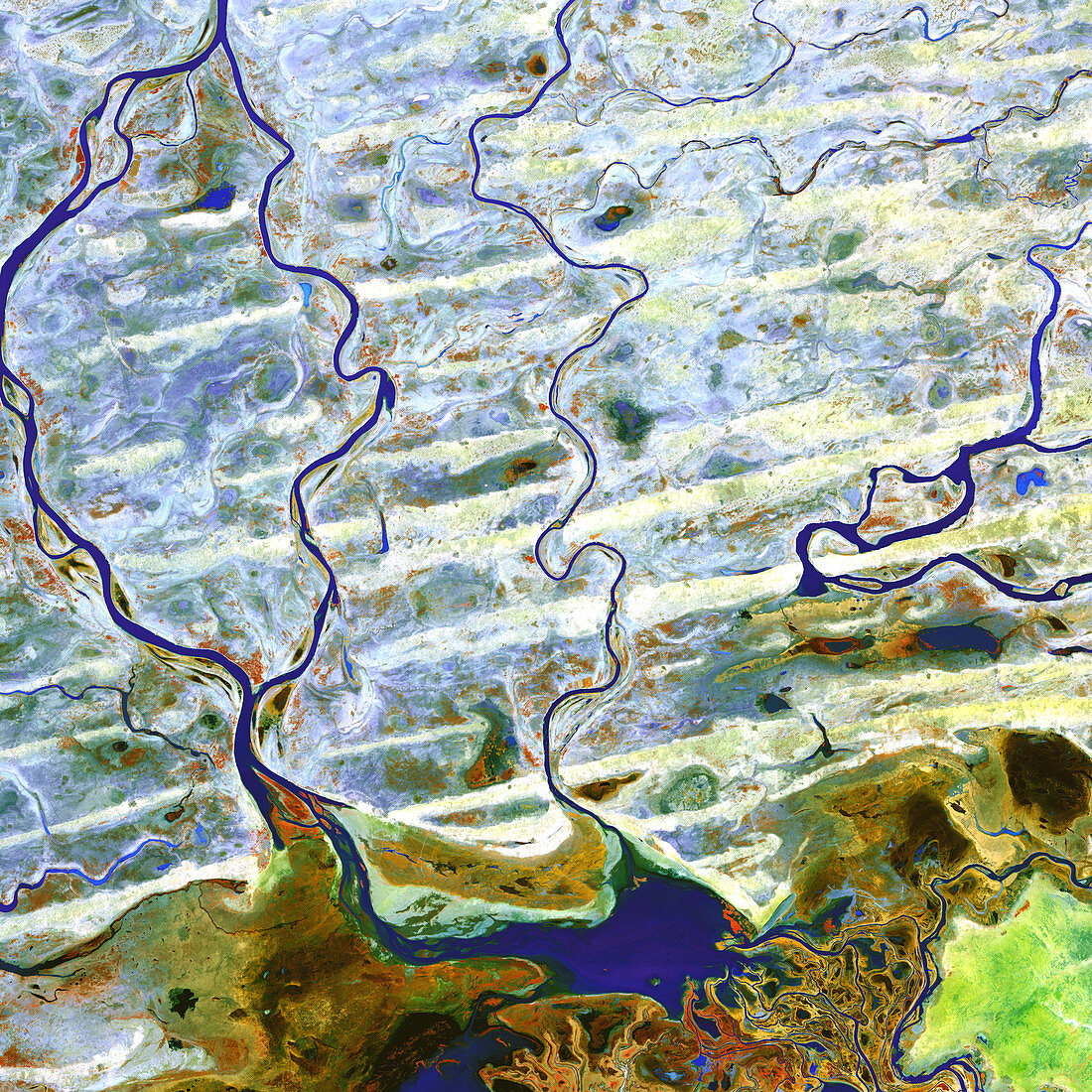
| Saharan desert rivers,satellite image. North is at top. Water is blue,desert areas are white,and fresh sediments and vegetation is orange/green. The waterways seen here are flowing from north to south to join the Inner Niger Delta (partially seen at bottom). The rivers at left are part of the Niger River. This region of the Sahara is in Mali. The Inner Niger Delta is a wetland oasis amid the sand dunes of the Sahara. The area shown in this image is around 60 kilometres wide. The image data includes infrared wavelengths,and was obtained on 8 February 2003,using the ASTER sensor on the Terra satellite | |
| Lizenzart: | Lizenzpflichtig |
| Credit: | Science Photo Library / NASA |
| Bildgröße: | 4800 px × 4800 px |
| Modell-Rechte: | nicht erforderlich |
| Eigentums-Rechte: | nicht erforderlich |
| Restrictions: | - |
Preise für dieses Bild ab 15 €
Universitäten & Organisationen
(Informationsmaterial Digital, Informationsmaterial Print, Lehrmaterial Digital etc.)
ab 15 €
Redaktionell
(Bücher, Bücher: Sach- und Fachliteratur, Digitale Medien (redaktionell) etc.)
ab 30 €
Werbung
(Anzeigen, Aussenwerbung, Digitale Medien, Fernsehwerbung, Karten, Werbemittel, Zeitschriften etc.)
ab 55 €
Handelsprodukte
(bedruckte Textilie, Kalender, Postkarte, Grußkarte, Verpackung etc.)
ab 75 €
Pauschalpreise
Rechtepakete für die unbeschränkte Bildnutzung in Print oder Online
ab 495 €
Keywords
- 2000er Jahre,
- 21. Jahrhundert,
- Afrika,
- Afrikanisch,
- Aster,
- Delta,
- Erdbeobachtung,
- Erdkunde,
- Februar,
- Felsig,
- Feuchtgebiet,
- Fluss,
- geografisch,
- Geographie,
- heiß,
- Hydrologie,
- infrarot,
- ir,
- Land,
- Mali,
- Natur,
- Reflexionsradiometer,
- sandig,
- Satellit,
- Satellitenbild,
- Terra,
- trocken,
- Umwelt,
- Wasser,
- Weltall,
- Wüste