River Nile,Egypt
Bildnummer 11744900
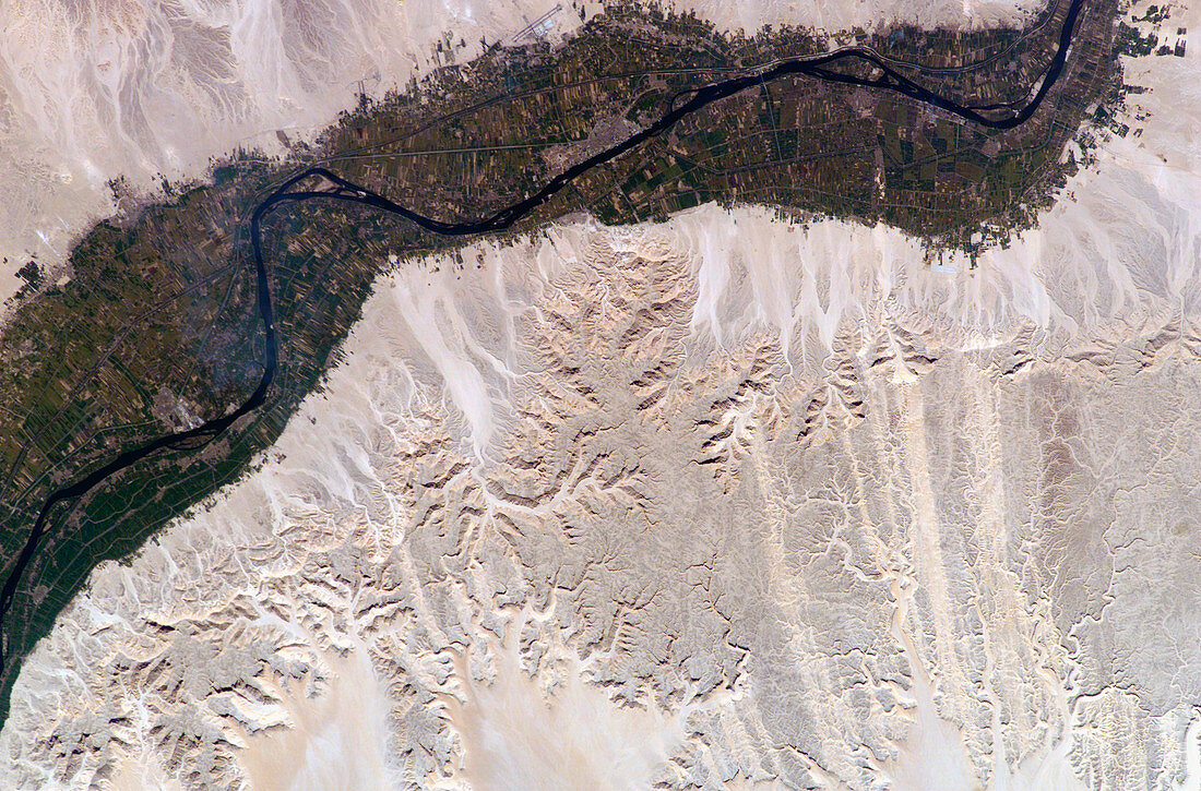
| River Nile,Egypt,seen from the International Space Station (ISS). North is towards bottom left. Agricultural fields (green) are sustained by the waters of the Nile (dark blue) as it flows right to left through the desert (brown). The Nile has eroded into the desert,leaving a plateau (up to 500 metres high) and the many water-eroded valleys seen here. Irrigation has enabled the farmed area to expand (top right) from the narrow floodplain onto the plateau slopes. This 60-kilometre-long stretch of the river flows past the city of Luxor (grey,upper centre) and its Ancient Egyptian ruins. The ISS orbits around 380 kilometres above the Earth. Photographed on 14 February 2003 | |
| Lizenzart: | Lizenzpflichtig |
| Credit: | Science Photo Library / NASA |
| Bildgröße: | 3032 px × 1998 px |
| Modell-Rechte: | nicht erforderlich |
| Eigentums-Rechte: | nicht erforderlich |
| Restrictions: | - |
Preise für dieses Bild ab 15 €
Universitäten & Organisationen
(Informationsmaterial Digital, Informationsmaterial Print, Lehrmaterial Digital etc.)
ab 15 €
Redaktionell
(Bücher, Bücher: Sach- und Fachliteratur, Digitale Medien (redaktionell) etc.)
ab 30 €
Werbung
(Anzeigen, Aussenwerbung, Digitale Medien, Fernsehwerbung, Karten, Werbemittel, Zeitschriften etc.)
ab 55 €
Handelsprodukte
(bedruckte Textilie, Kalender, Postkarte, Grußkarte, Verpackung etc.)
ab 75 €
Pauschalpreise
Rechtepakete für die unbeschränkte Bildnutzung in Print oder Online
ab 495 €
Keywords
- Afrika,
- Afrikanisch,
- Ägypten,
- Ägyptisch,
- Bauernhof,
- Bauernhöfe,
- bewässert,
- Bewässerung,
- Bodennutzung,
- Erdbeobachtung,
- erodiert,
- Erosion,
- Expedition sechs,
- Februar,
- Feld,
- Felder,
- Fluss,
- Fotografie,
- Geographie,
- Internationale Raumstation,
- ISS,
- kultiviert,
- Land,
- Landwirtschaft,
- landwirtschaftlich,
- Nil,
- Satellit,
- Tal,
- Täler,
- Umwelt,
- Wasser,
- Wüste