Mississippi River,USA
Bildnummer 11744898
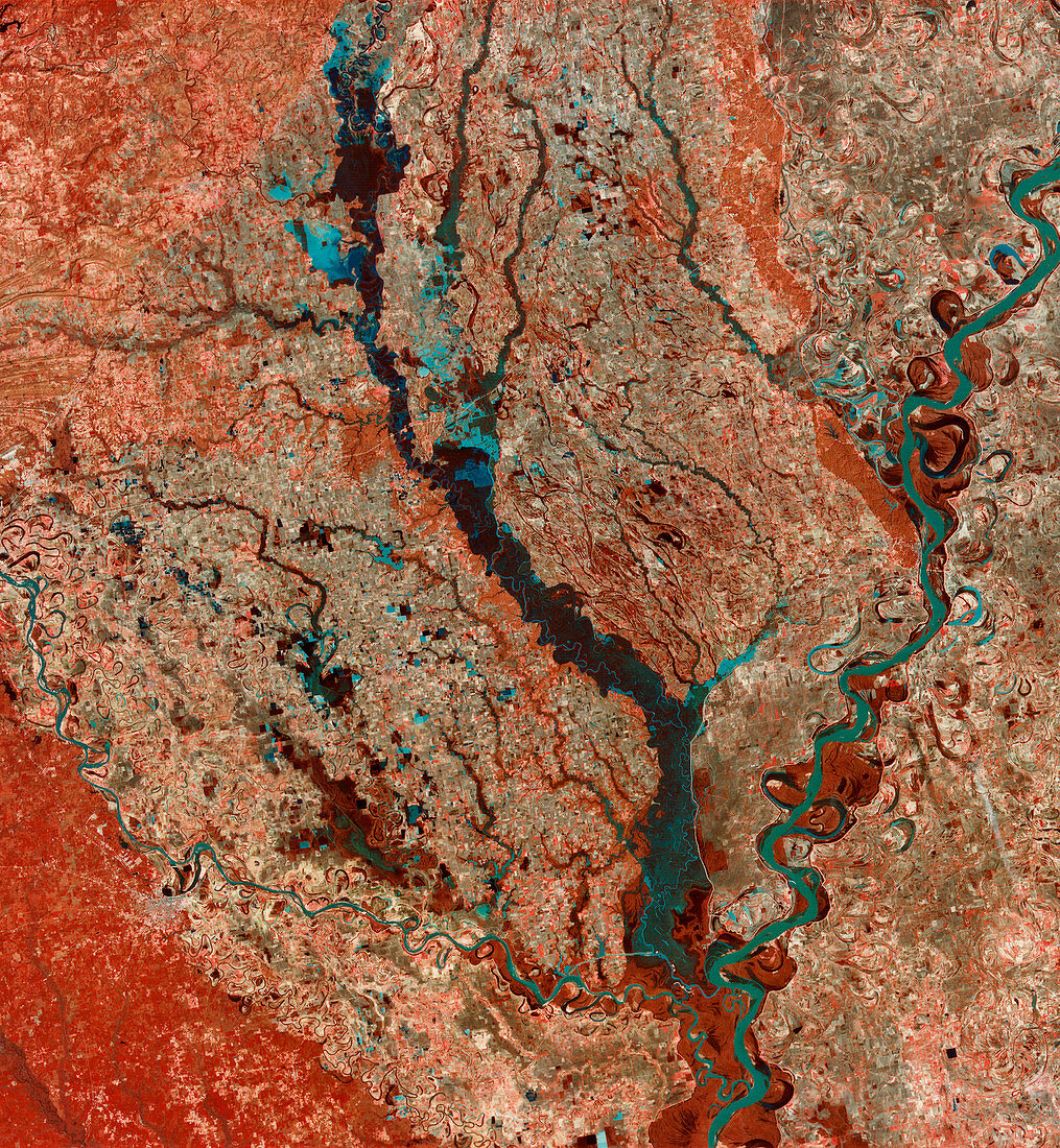
| Mississippi River,USA,infrared satellite image. North is at top. The Mississippi River (blue,down right) is the state border between Arkansas (left) and Mississippi. Here,it is in its flood plain,meandering through agricultural fields (white/red) to meet the Arkansas River (flowing upper left to lower right). Unlike the Mississippi,the Arkansas is allowed to flood and supports riverine wetlands (dark green). Vegetation is both luxuriant (red) and sparse (white). This 180-kilometre-wide image was taken on 23 February 1973,in visible and infrared wavelengths,by the Multispectral Scanner (MSS) sensor on NASA's Landsat 1 satellite | |
| Lizenzart: | Lizenzpflichtig |
| Credit: | Science Photo Library / MDA Information Systems |
| Bildgröße: | 4032 px × 4369 px |
| Modell-Rechte: | nicht erforderlich |
| Eigentums-Rechte: | nicht erforderlich |
| Restrictions: | - |
Preise für dieses Bild ab 15 €
Universitäten & Organisationen
(Informationsmaterial Digital, Informationsmaterial Print, Lehrmaterial Digital etc.)
ab 15 €
Redaktionell
(Bücher, Bücher: Sach- und Fachliteratur, Digitale Medien (redaktionell) etc.)
ab 30 €
Werbung
(Anzeigen, Aussenwerbung, Digitale Medien, Fernsehwerbung, Karten, Werbemittel, Zeitschriften etc.)
ab 55 €
Handelsprodukte
(bedruckte Textilie, Kalender, Postkarte, Grußkarte, Verpackung etc.)
ab 75 €
Pauschalpreise
Rechtepakete für die unbeschränkte Bildnutzung in Print oder Online
ab 495 €