Desolation Canyon,USA
Bildnummer 11744799
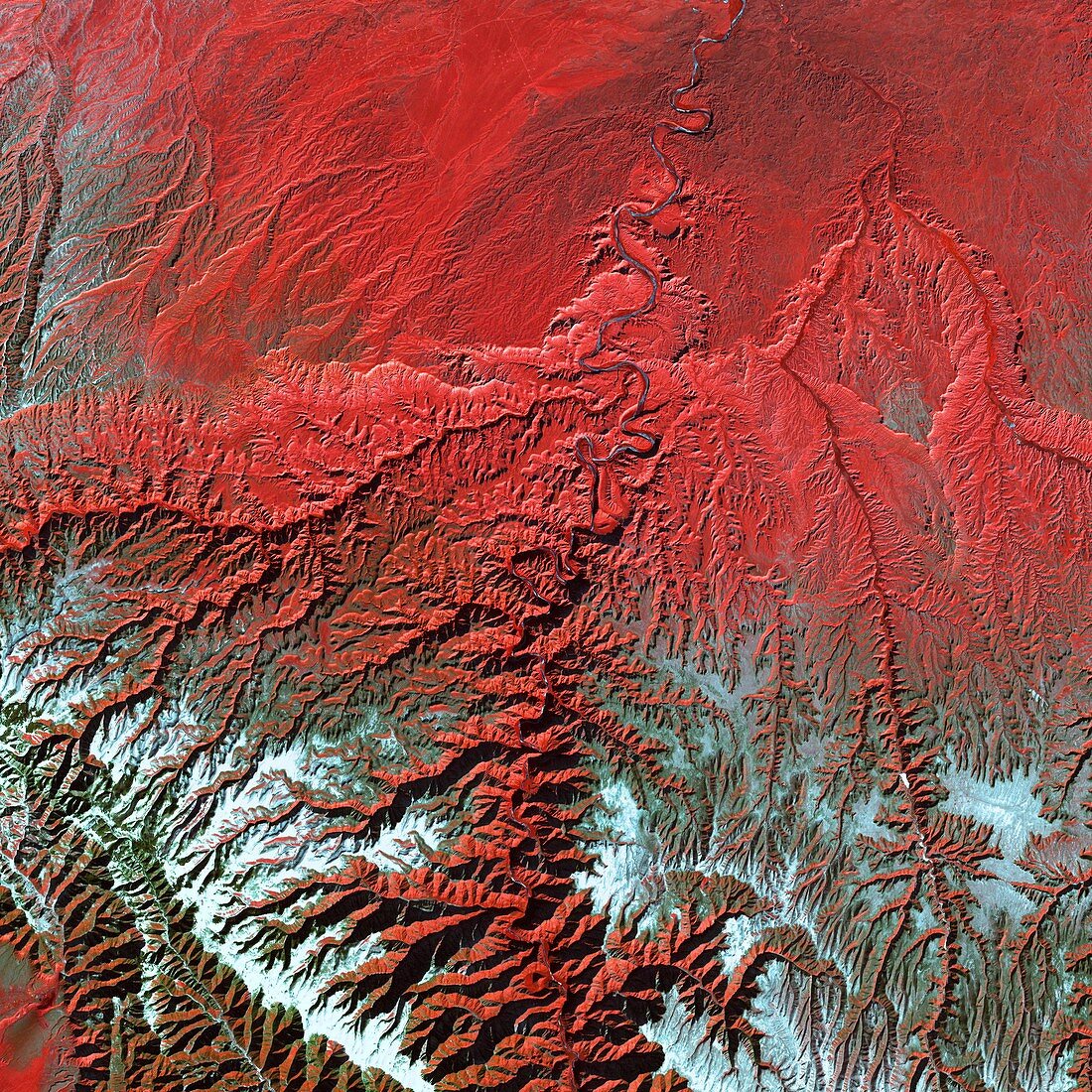
| Desolation Canyon,Utah,USA,satellite image. The canyon (mostly at centre) has been carved by the Green River that flows from top to bottom (weaving line). Vegetation is red and snow and ice are blue and white. The river flows through the relatively flat Tavaputs Plateau (top),before it enters the mountainous area (bottom) of the Roan and Book cliffs. Desolation Canyon winds through the cliffs for around 125 kilometres and is nearly as deep (1500 metres) as the Grand Canyon. This image is around 70 kilometres across. Image acquired in visible and infrared wavelengths on 31 December 2000 by the Enhanced Thematic Mapper Plus (ETM+) sensor on NASA's Landsat 7 satellite | |
| Lizenzart: | Lizenzpflichtig |
| Credit: | Science Photo Library / NASA |
| Bildgröße: | 4600 px × 4600 px |
| Modell-Rechte: | nicht erforderlich |
| Eigentums-Rechte: | nicht erforderlich |
| Restrictions: | - |
Preise für dieses Bild ab 15 €
Universitäten & Organisationen
(Informationsmaterial Digital, Informationsmaterial Print, Lehrmaterial Digital etc.)
ab 15 €
Redaktionell
(Bücher, Bücher: Sach- und Fachliteratur, Digitale Medien (redaktionell) etc.)
ab 30 €
Werbung
(Anzeigen, Aussenwerbung, Digitale Medien, Fernsehwerbung, Karten, Werbemittel, Zeitschriften etc.)
ab 55 €
Handelsprodukte
(bedruckte Textilie, Kalender, Postkarte, Grußkarte, Verpackung etc.)
ab 75 €
Pauschalpreise
Rechtepakete für die unbeschränkte Bildnutzung in Print oder Online
ab 495 €
Keywords
- 1,
- 2000,
- Amerika,
- Amerikanisch,
- Berg,
- Berge,
- Buch,
- Dezember,
- Eis,
- Erdbeobachtung,
- Erdkunde,
- erodiert,
- Erosion,
- etm,
- Fluss,
- geografisch,
- Geographie,
- Geologie,
- geologisch,
- Grün,
- infrarot,
- Klippe,
- Klippen,
- Landsat 7,
- optisch,
- Plateau,
- Satellit,
- Schluchten,
- Schnee,
- Sichtbar,
- Tal,
- Täler,
- topografisch,
- Topographie,
- topographisch,
- Umwelt,
- uns,
- USA,
- Utah,
- Vegetation,
- Vereinigte Staaten,
- Wasser,
- Weltall