Cucharas River Canyon,radar image
Bildnummer 11744796
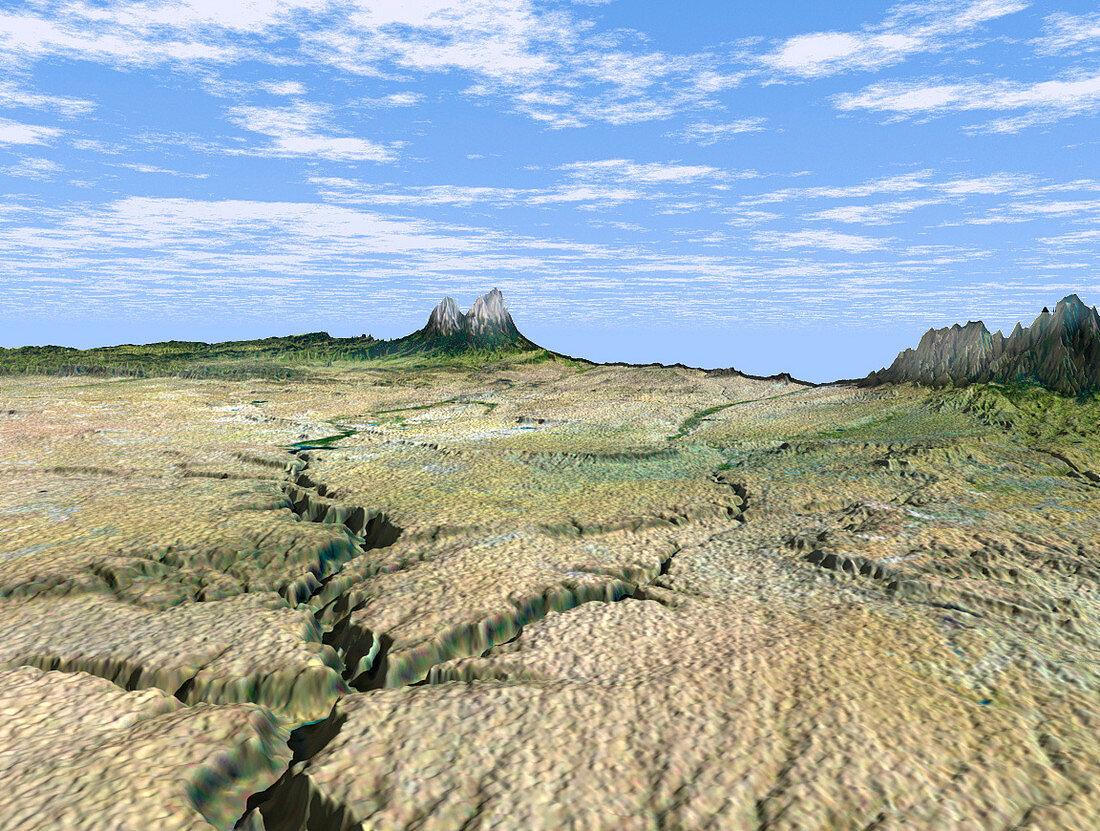
| Cucharas River Canyon. Coloured three-dimensional computer map of the Cucharas River Canyon (lower frame) running towards the Spanish Peak mountains (across centre) in southern Colorado,USA. The topography of the region was mapped by the Shuttle Radar Topography Mission (SRTM) on the Space Shuttle Endeavour,using reflected radar pulses. Colour was provided by the Landsat 5 satellite. The Spanish Peaks,which rise to around 2100 metres,are the igneous remnants of a 20-million- year-old volcano. SRTM is run by NASA,the USA's National Imagery and Mapping Agency (NIMA),and the German and Italian space agencies | |
| Lizenzart: | Lizenzpflichtig |
| Credit: | Science Photo Library / NASA |
| Bildgröße: | 1152 px × 870 px |
| Modell-Rechte: | nicht erforderlich |
| Eigentums-Rechte: | nicht erforderlich |
| Restrictions: | - |
Preise für dieses Bild ab 15 €
Universitäten & Organisationen
(Informationsmaterial Digital, Informationsmaterial Print, Lehrmaterial Digital etc.)
ab 15 €
Redaktionell
(Bücher, Bücher: Sach- und Fachliteratur, Digitale Medien (redaktionell) etc.)
ab 30 €
Werbung
(Anzeigen, Aussenwerbung, Digitale Medien, Fernsehwerbung, Karten, Werbemittel, Zeitschriften etc.)
ab 55 €
Handelsprodukte
(bedruckte Textilie, Kalender, Postkarte, Grußkarte, Verpackung etc.)
ab 75 €
Pauschalpreise
Rechtepakete für die unbeschränkte Bildnutzung in Print oder Online
ab 495 €
Keywords
- 3-d,
- abgebildet,
- Amerika,
- Amerikanisch,
- Berg,
- Berge,
- Colorado,
- Deutsche,
- Deutschland,
- Dreidimensional,
- farbig,
- Formation,
- Formationen,
- fünf,
- geografisch,
- Geographie,
- Geologie,
- geologisch,
- Gipfel,
- Italien,
- Italienisch,
- Karte,
- Karten,
- Land,
- Mission,
- NASA,
- Oberfläche,
- Satellit,
- SRTM,
- Süd-,
- Terrain,
- topografisch,
- uns,
- Vereinigte Staaten,
- Weltall