San Fernando Valley,3-D satellite map
Bildnummer 11744787
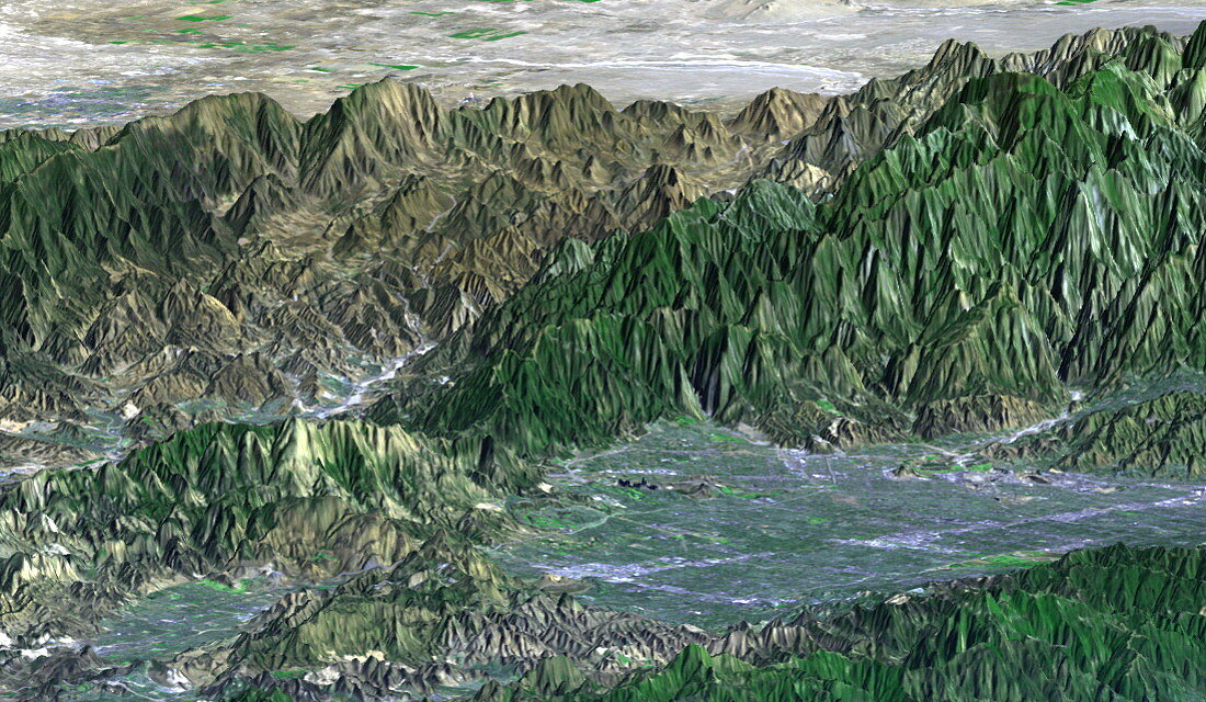
| San Fernando Valley. Coloured three-dimensional topography map of the San Fernando Valley (grey,lower right) in Los Angeles,California,USA. This densely-populated area is prone to earthquakes. It is hoped that by modelling the landforms in the area,new buildings can be built in areas at the least risk of earthquake damage. These data also allow researchers to see how previous earthquakes have affected the area. The image was created by the Shuttle Radar Topography Mission (SRTM) on board the Space Shuttle Endeavour on 16th February 2000. A 1986 Landsat colour image of the area was overlaid on the elevation data | |
| Lizenzart: | Lizenzpflichtig |
| Credit: | Science Photo Library / NASA |
| Bildgröße: | 1099 px × 639 px |
| Modell-Rechte: | nicht erforderlich |
| Eigentums-Rechte: | nicht erforderlich |
| Restrictions: | - |
Preise für dieses Bild ab 15 €
Universitäten & Organisationen
(Informationsmaterial Digital, Informationsmaterial Print, Lehrmaterial Digital etc.)
ab 15 €
Redaktionell
(Bücher, Bücher: Sach- und Fachliteratur, Digitale Medien (redaktionell) etc.)
ab 30 €
Werbung
(Anzeigen, Aussenwerbung, Digitale Medien, Fernsehwerbung, Karten, Werbemittel, Zeitschriften etc.)
ab 55 €
Handelsprodukte
(bedruckte Textilie, Kalender, Postkarte, Grußkarte, Verpackung etc.)
ab 75 €
Pauschalpreise
Rechtepakete für die unbeschränkte Bildnutzung in Print oder Online
ab 495 €