ERS-1 image of Darmstadt and the Rhine Valley
Bildnummer 11744781
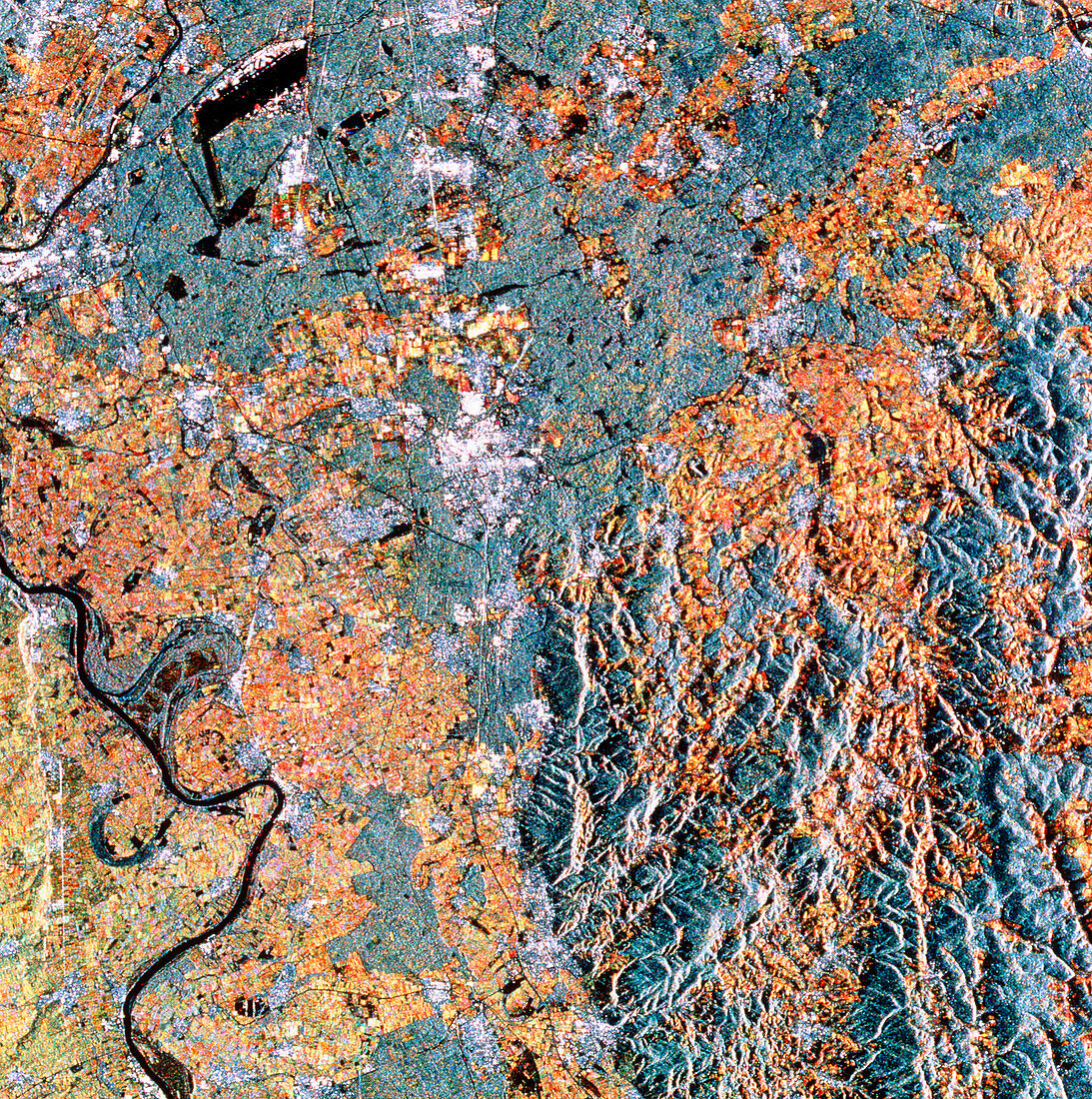
| Rhine Valley. ERS-1 radar image showing part of the Rhine Valley in Germany. The Rhine River may be seen in the lower left; the rich agricultural fields of the valley are seen in reddish tones. The slightly greener tones in the lower left corner are vineyards in the Rheinhessen region. Grey regions are forests which stretch into the Oberwald mountains at lower right. The white area at centre is the city of Darmstadt. The black 'L'- shaped feature in upper left is Frankfurt Airport. The data for this image were gathered by the European ERS-1 radar mapping satellite | |
| Lizenzart: | Lizenzpflichtig |
| Credit: | Science Photo Library / ESA, EURIMAGE |
| Bildgröße: | 4734 px × 4764 px |
| Modell-Rechte: | nicht erforderlich |
| Eigentums-Rechte: | nicht erforderlich |
| Restrictions: |
|
Preise für dieses Bild ab 15 €
Universitäten & Organisationen
(Informationsmaterial Digital, Informationsmaterial Print, Lehrmaterial Digital etc.)
ab 15 €
Redaktionell
(Bücher, Bücher: Sach- und Fachliteratur, Digitale Medien (redaktionell) etc.)
ab 30 €
Werbung
(Anzeigen, Aussenwerbung, Digitale Medien, Fernsehwerbung, Karten, Werbemittel, Zeitschriften etc.)
ab 55 €
Handelsprodukte
(bedruckte Textilie, Kalender, Postkarte, Grußkarte, Verpackung etc.)
ab 75 €
Pauschalpreise
Rechtepakete für die unbeschränkte Bildnutzung in Print oder Online
ab 495 €