Mountains,Turkey
Bildnummer 11744687
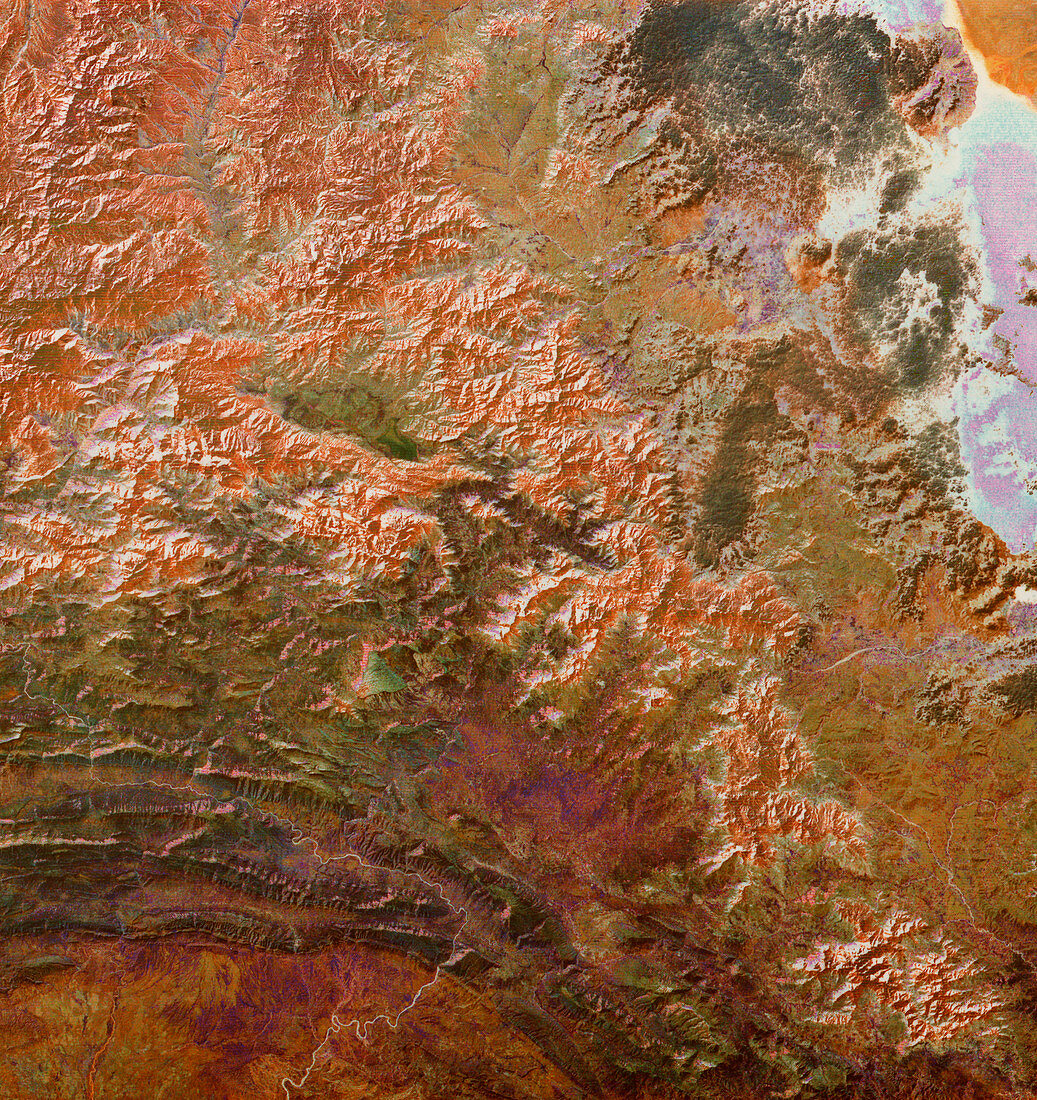
| Mountains,Turkey,infrared satellite image. North is at top. These mountains,part of the Taurus Mountains,rise to heights of over 3000 metres. Turkish land is at upper left,while the Great Zab River (lower left) is in Iraq,and Lake Urmia (pink/blue,top right) is in Iran. This 180- kilometre-wide image was taken on 21 November 1972,in visible and infrared wavelengths,with the Multispectral Scanner (MSS) sensor on NASA's Landsat 1 satellite | |
| Lizenzart: | Lizenzpflichtig |
| Credit: | Science Photo Library / MDA Information Systems |
| Bildgröße: | 4060 px × 4306 px |
| Modell-Rechte: | nicht erforderlich |
| Eigentums-Rechte: | nicht erforderlich |
| Restrictions: | - |
Preise für dieses Bild ab 15 €
Universitäten & Organisationen
(Informationsmaterial Digital, Informationsmaterial Print, Lehrmaterial Digital etc.)
ab 15 €
Redaktionell
(Bücher, Bücher: Sach- und Fachliteratur, Digitale Medien (redaktionell) etc.)
ab 30 €
Werbung
(Anzeigen, Aussenwerbung, Digitale Medien, Fernsehwerbung, Karten, Werbemittel, Zeitschriften etc.)
ab 55 €
Handelsprodukte
(bedruckte Textilie, Kalender, Postkarte, Grußkarte, Verpackung etc.)
ab 75 €
Pauschalpreise
Rechtepakete für die unbeschränkte Bildnutzung in Print oder Online
ab 495 €
Keywords
- Asiatisch,
- Asien,
- Berg,
- Berge,
- einer,
- Erdbeobachtung,
- geografisch,
- Geographie,
- Geologie,
- geologisch,
- infrarot,
- Irak,
- Iran,
- iranisch,
- Landsat 1,
- Mittlerer Osten,
- montan,
- mss,
- Multispektral,
- November,
- Rand,
- Satellit,
- Stier,
- Truthahn,
- Türkisch,
- Umwelt,
- Weltall,
- Winter