Mont Blanc,satellite image
Bildnummer 11744679
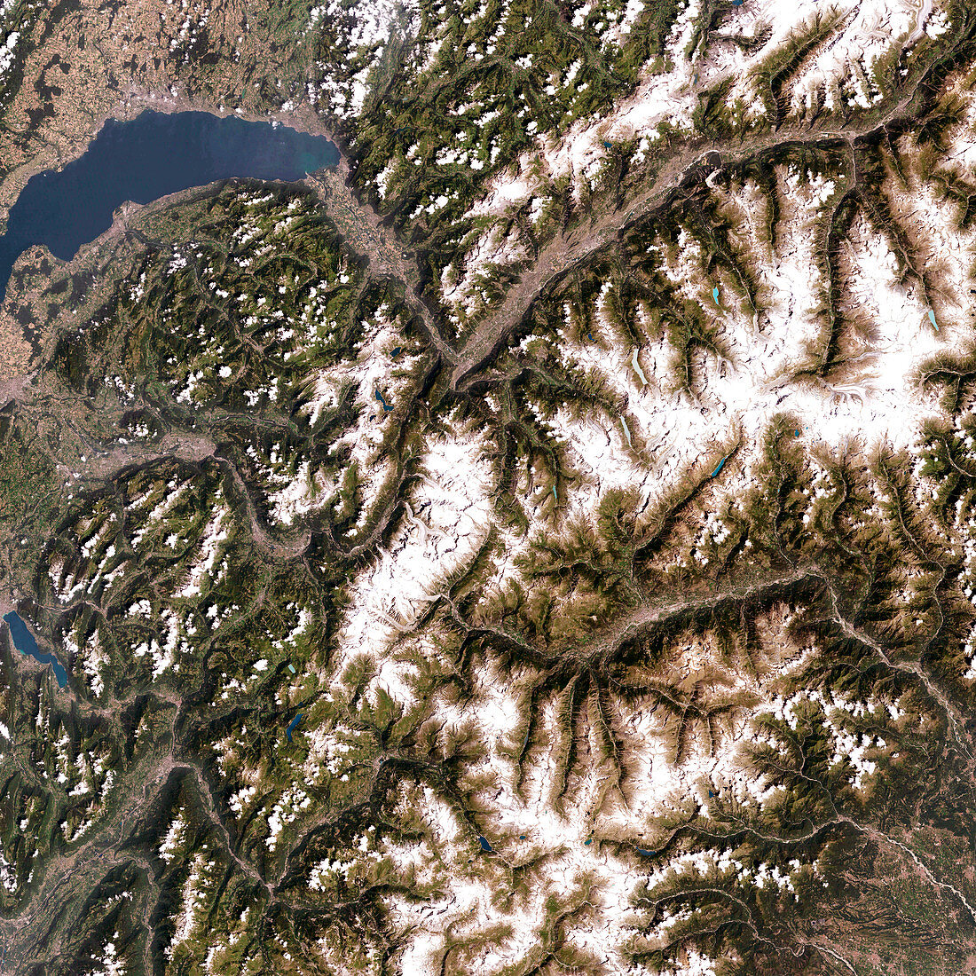
| Mont Blanc,satellite image. North is at top. Mont Blanc (centre) is western Europe's highest mountain,at 4807 metres tall. The large body of water at upper left is Lake Geneva in Switzerland. Mont Blanc itself lies on the French-Italian border,with France to the west (left) and Italy to the east. The Alps,of which Mont Blanc is a part,is a mountain range formed over the last 100 million years by the northward movement of the African tectonic plate relative to the Eurasian plate. This image was taken by the Enhanced Thematic Mapper Plus (ETM+) on the Landsat 7 satellite on July 30th 2001 | |
| Lizenzart: | Lizenzpflichtig |
| Credit: | Science Photo Library / NASA |
| Bildgröße: | 4000 px × 4000 px |
| Modell-Rechte: | nicht erforderlich |
| Eigentums-Rechte: | nicht erforderlich |
| Restrictions: | - |
Preise für dieses Bild ab 15 €
Universitäten & Organisationen
(Informationsmaterial Digital, Informationsmaterial Print, Lehrmaterial Digital etc.)
ab 15 €
Redaktionell
(Bücher, Bücher: Sach- und Fachliteratur, Digitale Medien (redaktionell) etc.)
ab 30 €
Werbung
(Anzeigen, Aussenwerbung, Digitale Medien, Fernsehwerbung, Karten, Werbemittel, Zeitschriften etc.)
ab 55 €
Handelsprodukte
(bedruckte Textilie, Kalender, Postkarte, Grußkarte, Verpackung etc.)
ab 75 €
Pauschalpreise
Rechtepakete für die unbeschränkte Bildnutzung in Print oder Online
ab 495 €