Anti-Atlas mountains
Bildnummer 11744678
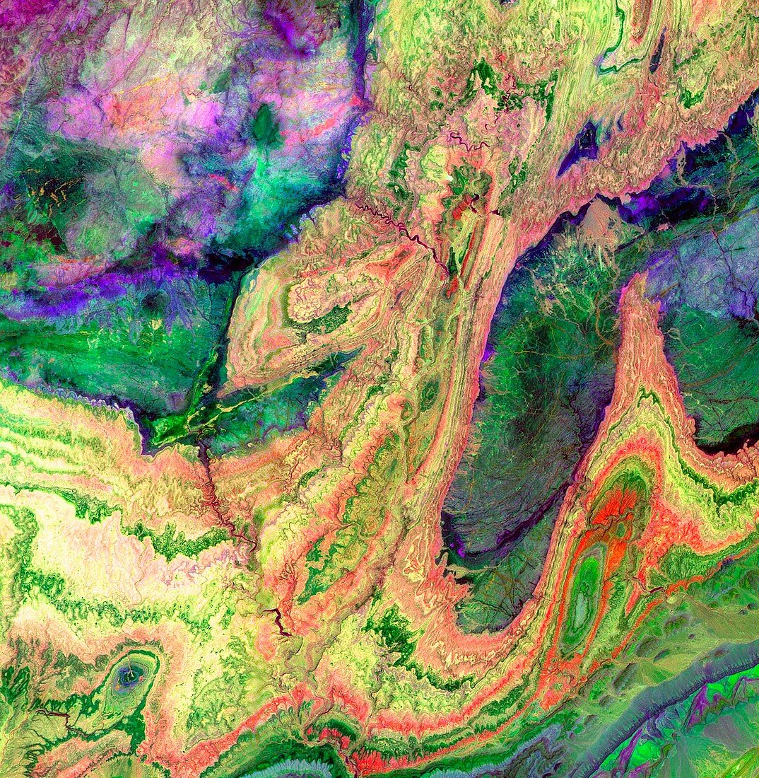
| Anti-Atlas mountains,Morocco,infrared satellite image. North is at top. This is at the western end of the Anti-Atlas Mountain Range in Morocco. This image shows an area that is 28.7 x 29.4 kilometres in size. Infrared viewing reveals the geology of the area. Limestone,sandstone and gypsum (yellow,orange,green) are sedimentary rocks that were deposited under an ancient ocean. Granite rocks (dark blue/green) are also seen. The collision of Africa and Eurasia (80 million years ago) crumpled and raised the seabed into mountains. Photographed on 13 June 2001 by the Advanced Spaceborne Thermal Emission and Reflection Radiometer (ASTER) sensor,carried on board NASA's Terra satellite | |
| Lizenzart: | Lizenzpflichtig |
| Credit: | Science Photo Library / NASA |
| Bildgröße: | 1378 px × 1411 px |
| Modell-Rechte: | nicht erforderlich |
| Eigentums-Rechte: | nicht erforderlich |
| Restrictions: | - |
Preise für dieses Bild ab 15 €
Universitäten & Organisationen
(Informationsmaterial Digital, Informationsmaterial Print, Lehrmaterial Digital etc.)
ab 15 €
Redaktionell
(Bücher, Bücher: Sach- und Fachliteratur, Digitale Medien (redaktionell) etc.)
ab 30 €
Werbung
(Anzeigen, Aussenwerbung, Digitale Medien, Fernsehwerbung, Karten, Werbemittel, Zeitschriften etc.)
ab 55 €
Handelsprodukte
(bedruckte Textilie, Kalender, Postkarte, Grußkarte, Verpackung etc.)
ab 75 €
Pauschalpreise
Rechtepakete für die unbeschränkte Bildnutzung in Print oder Online
ab 495 €