MacDonnell Mountains,Australia
Bildnummer 11744675
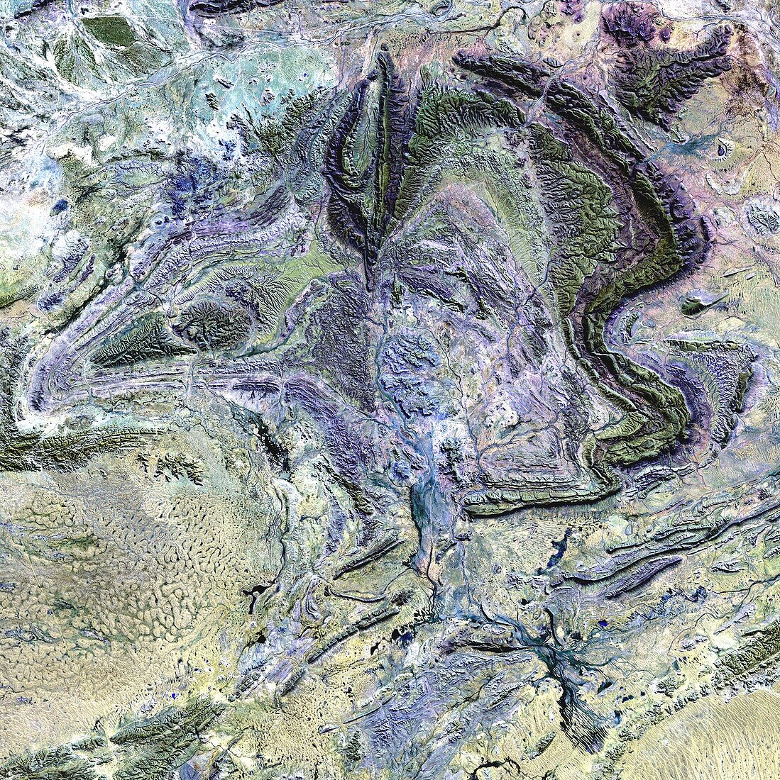
| MacDonnell Mountains,Australia,satellite image. This is a view of part of the MacDonnell Mountains in Australia's arid centre. The mountains rise to 1000-1500 metres. Erosion of the rock has revealed the original banding of the rock layers (strata) that were crumpled upwards by tectonic forces to form these mountains. Eroded valleys line the side of the mountain ridges that form large loops and whorls in this landscape. Sand dunes (yellow) are seen in the bottom right corner. Image acquired in visible and infrared wavelengths on 1 August 2000 by the Enhanced Thematic Mapper Plus (ETM+) sensor on NASA's Landsat 7 satellite | |
| Lizenzart: | Lizenzpflichtig |
| Credit: | Science Photo Library / NASA |
| Bildgröße: | 4525 px × 4530 px |
| Modell-Rechte: | nicht erforderlich |
| Eigentums-Rechte: | nicht erforderlich |
| Restrictions: | - |
Preise für dieses Bild ab 15 €
Universitäten & Organisationen
(Informationsmaterial Digital, Informationsmaterial Print, Lehrmaterial Digital etc.)
ab 15 €
Redaktionell
(Bücher, Bücher: Sach- und Fachliteratur, Digitale Medien (redaktionell) etc.)
ab 30 €
Werbung
(Anzeigen, Aussenwerbung, Digitale Medien, Fernsehwerbung, Karten, Werbemittel, Zeitschriften etc.)
ab 55 €
Handelsprodukte
(bedruckte Textilie, Kalender, Postkarte, Grußkarte, Verpackung etc.)
ab 75 €
Pauschalpreise
Rechtepakete für die unbeschränkte Bildnutzung in Print oder Online
ab 495 €
Keywords
- 2000,
- August,
- Australien,
- australisch,
- Berg,
- Erdbeobachtung,
- Erdkunde,
- erodiert,
- Erosion,
- etm,
- Felsen,
- Felsig,
- geografisch,
- Geographie,
- Geologie,
- geologisch,
- Geschichtet,
- Grat,
- infrarot,
- Landsat 7,
- optisch,
- Satellit,
- Schicht,
- Schichten,
- Sichtbar,
- topografisch,
- Topographie,
- topographisch,
- trocken,
- Umwelt,
- Weltall,
- Wüste,
- zentral,
- Zentrum