Coloured radar satellite image of Italian Alps
Bildnummer 11744643
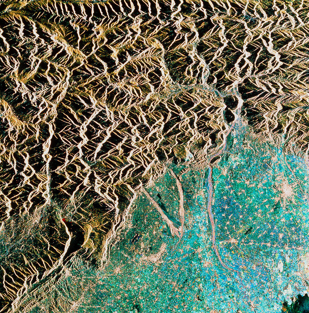
| Italian Alps. Coloured radar satellite image of the Alps in northeast Italy. North is towards the top. This image was made by combining three frames taken at different dates. Changes in the appearance of the land between the dates show up as coloured areas,while unchanged areas appear white or black. Agricultural land appears blue and green. The light-coloured patch in the centre right is the town of Udine. The Mediterranean Sea can just be seen in the bottom right corner. The brown streaks descending south from the mountains are river valleys. Image produced by European Radar Satellite 1. The area shown is approximately 100km x 100km | |
| Lizenzart: | Lizenzpflichtig |
| Credit: | Science Photo Library / ESA, EURIMAGE |
| Bildgröße: | 4201 px × 4252 px |
| Modell-Rechte: | nicht erforderlich |
| Eigentums-Rechte: | nicht erforderlich |
| Restrictions: |
|
Preise für dieses Bild ab 15 €
Universitäten & Organisationen
(Informationsmaterial Digital, Informationsmaterial Print, Lehrmaterial Digital etc.)
ab 15 €
Redaktionell
(Bücher, Bücher: Sach- und Fachliteratur, Digitale Medien (redaktionell) etc.)
ab 30 €
Werbung
(Anzeigen, Aussenwerbung, Digitale Medien, Fernsehwerbung, Karten, Werbemittel, Zeitschriften etc.)
ab 55 €
Handelsprodukte
(bedruckte Textilie, Kalender, Postkarte, Grußkarte, Verpackung etc.)
ab 75 €
Pauschalpreise
Rechtepakete für die unbeschränkte Bildnutzung in Print oder Online
ab 495 €
Keywords
- Alpen,
- Berg,
- ERS-1,
- Fluss,
- Friuli,
- Geographie,
- Italien,
- Italienisch,
- Tagliamento,
- Udine,
- Umwelt,
- Weltall