Geology aroung Yangtze River,China
Bildnummer 11744598
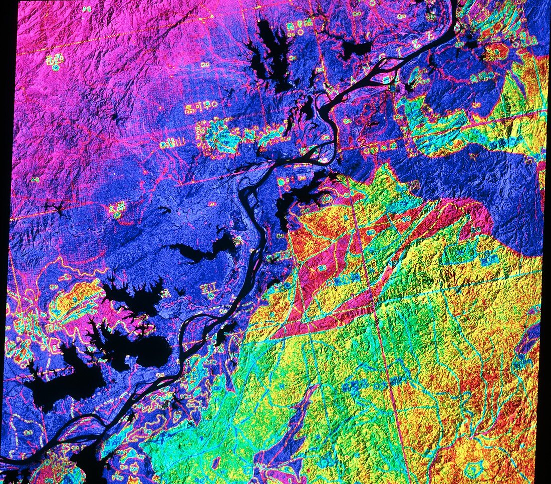
| Geology map of part of China. False-coloured satellite image showing part of Anhui Province,China. Colours have been laid on top of a monochrome satellite image to indicate the complex surface geology of the region. The dark diagonal line is part of the Chang Jiang (Yangtze) River. Large black areas are lakes. This sort of map is used in a variety of remote sensing applications such as petroleum and mineral prospecting. The data for this image were gathered by a Landsat satellite | |
| Lizenzart: | Lizenzpflichtig |
| Credit: | Science Photo Library / NRSC / BP |
| Bildgröße: | 4621 px × 4064 px |
| Modell-Rechte: | nicht erforderlich |
| Eigentums-Rechte: | nicht erforderlich |
| Restrictions: | - |
Preise für dieses Bild ab 15 €
Universitäten & Organisationen
(Informationsmaterial Digital, Informationsmaterial Print, Lehrmaterial Digital etc.)
ab 15 €
Redaktionell
(Bücher, Bücher: Sach- und Fachliteratur, Digitale Medien (redaktionell) etc.)
ab 30 €
Werbung
(Anzeigen, Aussenwerbung, Digitale Medien, Fernsehwerbung, Karten, Werbemittel, Zeitschriften etc.)
ab 55 €
Handelsprodukte
(bedruckte Textilie, Kalender, Postkarte, Grußkarte, Verpackung etc.)
ab 75 €
Pauschalpreise
Rechtepakete für die unbeschränkte Bildnutzung in Print oder Online
ab 495 €