Mackenzie Bay,Canada
Bildnummer 11744597
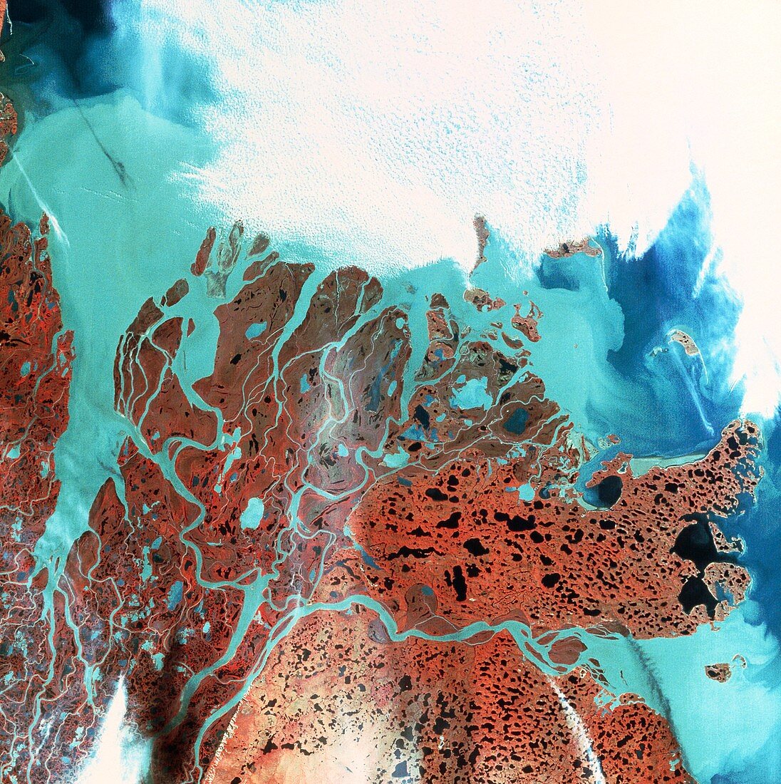
| Mackenzie Bay,Canada. False-colour satellite image showing Mackenzie Bay in the far north-west of Canada. The Bay is at top left. In the centre is Richards Island,a large delta formed by sediments from the Mackenzie River. Sedimentation is seen as the pale blue areas,the deeper blue of the Beaufort Sea is largely obscured by cloud cover (white). The reddish brown colour of the land represents tundra vegetation. The data for this image were gathered by a Landsat satellite | |
| Lizenzart: | Lizenzpflichtig |
| Credit: | Science Photo Library / NRSC / BP |
| Bildgröße: | 4193 px × 4209 px |
| Modell-Rechte: | nicht erforderlich |
| Eigentums-Rechte: | nicht erforderlich |
| Restrictions: | - |
Preise für dieses Bild ab 15 €
Universitäten & Organisationen
(Informationsmaterial Digital, Informationsmaterial Print, Lehrmaterial Digital etc.)
ab 15 €
Redaktionell
(Bücher, Bücher: Sach- und Fachliteratur, Digitale Medien (redaktionell) etc.)
ab 30 €
Werbung
(Anzeigen, Aussenwerbung, Digitale Medien, Fernsehwerbung, Karten, Werbemittel, Zeitschriften etc.)
ab 55 €
Handelsprodukte
(bedruckte Textilie, Kalender, Postkarte, Grußkarte, Verpackung etc.)
ab 75 €
Pauschalpreise
Rechtepakete für die unbeschränkte Bildnutzung in Print oder Online
ab 495 €