Landsat image of Bighorn Basin,USA
Bildnummer 11744593
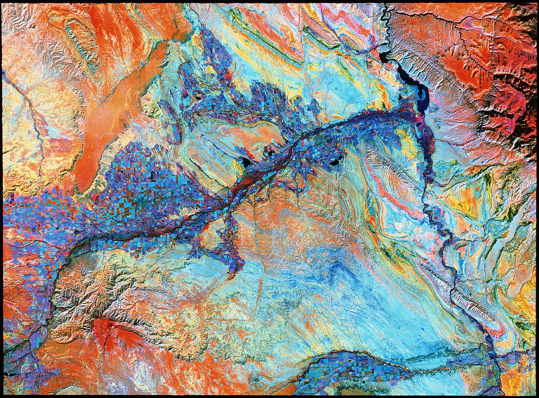
| Rock formations and land use in Wyoming. False- colour infrared image of the Bighorn Basin in Wyoming,USA. The Bighorn River is seen running from top to bottom near the right. The Shoshone River runs from bottom left,meeting the Bighorn near top right. The northern (upper) bank of the Shoshone has a large aggregate of irrigated fields (blue/purple). At bottom right the line of Dry Creek is seen,with a smaller aggregate of fields just right of bottom centre. The banded rock formations appear multicoloured,and are particularly clear. This image was made by the Thematic Mapper of a Landsat satellite in 1991 | |
| Lizenzart: | Lizenzpflichtig |
| Credit: | Science Photo Library / MDA Information Systems |
| Bildgröße: | 4316 px × 3185 px |
| Modell-Rechte: | nicht erforderlich |
| Eigentums-Rechte: | nicht erforderlich |
| Restrictions: | - |
Preise für dieses Bild ab 15 €
Universitäten & Organisationen
(Informationsmaterial Digital, Informationsmaterial Print, Lehrmaterial Digital etc.)
ab 15 €
Redaktionell
(Bücher, Bücher: Sach- und Fachliteratur, Digitale Medien (redaktionell) etc.)
ab 30 €
Werbung
(Anzeigen, Aussenwerbung, Digitale Medien, Fernsehwerbung, Karten, Werbemittel, Zeitschriften etc.)
ab 55 €
Handelsprodukte
(bedruckte Textilie, Kalender, Postkarte, Grußkarte, Verpackung etc.)
ab 75 €
Pauschalpreise
Rechtepakete für die unbeschränkte Bildnutzung in Print oder Online
ab 495 €