Igneous rock landscape
Bildnummer 11741672
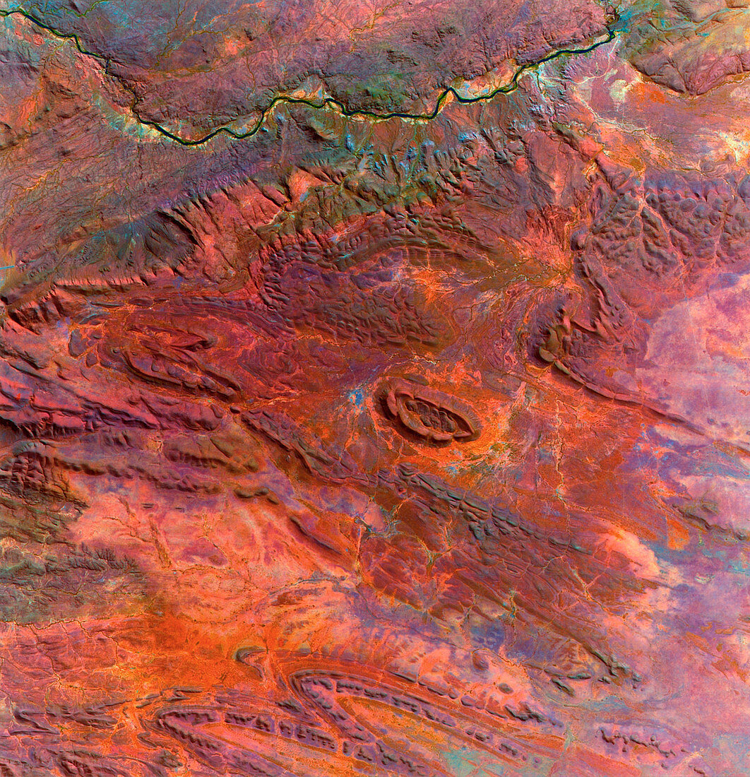
| Igneous rock landscape,Namibia,satellite image. North is at top. The colours of the landscape have been enhanced with a GeoVue spectral transform of the data. Eroded mountain features are prominent (one at centre),including ridges of harder rocks that have resisted erosion. This is the 2,100- million-year-old Kunene Igneous Complex of Angola and northern Namibia. It formed as an intrusion of molten rock (magma) from below the Earth's crust. This 50-kilometre-wide image was taken on 23 June 1991 with the Thematic Mapper (TM) sensor on a NASA Landsat satellite | |
| Lizenzart: | Lizenzpflichtig |
| Credit: | Science Photo Library / MDA Information Systems |
| Bildgröße: | 4105 px × 4253 px |
| Modell-Rechte: | nicht erforderlich |
| Eigentums-Rechte: | nicht erforderlich |
| Restrictions: | - |
Preise für dieses Bild ab 15 €
Universitäten & Organisationen
(Informationsmaterial Digital, Informationsmaterial Print, Lehrmaterial Digital etc.)
ab 15 €
Redaktionell
(Bücher, Bücher: Sach- und Fachliteratur, Digitale Medien (redaktionell) etc.)
ab 30 €
Werbung
(Anzeigen, Aussenwerbung, Digitale Medien, Fernsehwerbung, Karten, Werbemittel, Zeitschriften etc.)
ab 55 €
Handelsprodukte
(bedruckte Textilie, Kalender, Postkarte, Grußkarte, Verpackung etc.)
ab 75 €
Pauschalpreise
Rechtepakete für die unbeschränkte Bildnutzung in Print oder Online
ab 495 €
Keywords
- Afrika,
- Afrikanisch,
- Berg,
- Berge,
- Erdkunde,
- erodiert,
- Erosion,
- Erweiterung,
- farbig,
- Felsen,
- Felsig,
- geografisch,
- Geographie,
- Geologie,
- geologisch,
- Juni,
- komplex,
- Kunene,
- Landschaft,
- magmatisch,
- montan,
- Namibia,
- namibisch,
- Satellit,
- Schichten,
- Tm,
- trocken,
- unfruchtbar,
- verbessert,
- Weltall,
- Wüste