Eroded dome mountain
Bildnummer 11741328
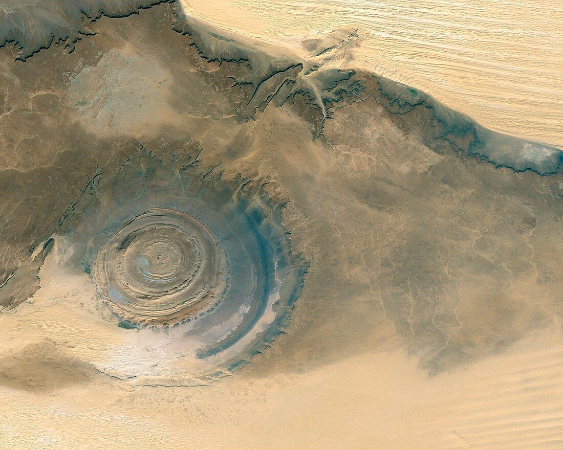
| Eroded dome mountain. Satellite image of an eroded dome mountain,in the deserts of Mauritania,known as the Richat Structure. The erosion of this dome mountain,to a height of 485 metres,has revealed the rock layers (strata) that were uplifted in the upheaval that formed the mountain. The symmetrical dome structure has left concentric rings of these strata. It is nearly 50 kilometres across. Ripples (sand dunes) run over the desert sands (light brown),showing the prevailing wind direction | |
| Lizenzart: | Lizenzpflichtig |
| Credit: | Science Photo Library / Worldsat International |
| Bildgröße: | 4200 px × 3360 px |
| Modell-Rechte: | nicht erforderlich |
| Eigentums-Rechte: | nicht erforderlich |
| Restrictions: |
|
Preise für dieses Bild ab 15 €
Universitäten & Organisationen
(Informationsmaterial Digital, Informationsmaterial Print, Lehrmaterial Digital etc.)
ab 15 €
Redaktionell
(Bücher, Bücher: Sach- und Fachliteratur, Digitale Medien (redaktionell) etc.)
ab 30 €
Werbung
(Anzeigen, Aussenwerbung, Digitale Medien, Fernsehwerbung, Karten, Werbemittel, Zeitschriften etc.)
ab 55 €
Handelsprodukte
(bedruckte Textilie, Kalender, Postkarte, Grußkarte, Verpackung etc.)
ab 75 €
Pauschalpreise
Rechtepakete für die unbeschränkte Bildnutzung in Print oder Online
ab 495 €
Keywords
- Afrika,
- Afrikanisch,
- Berg,
- beringt,
- Düne,
- Dünen,
- Erdbeobachtung,
- Erdkunde,
- erodiert,
- Erosion,
- geografisch,
- Geographie,
- Geologie,
- Geschichtet,
- Gesteinsschichten,
- konzentrisch,
- Kreis,
- Kreise,
- kreisförmig,
- Kuppel,
- Land,
- Mauretanien,
- optisch,
- Ring,
- Ringe,
- Sand,
- sandig,
- Satellit,
- Schicht,
- Schichten,
- Sichtbar,
- topografisch,
- Topographie,
- topographisch,
- trocken,
- Wasser,
- Weltall,
- wolkenfrei,
- wolkenlos,
- Wüste,
- Ziel