Volcanic landscape,satellite image
Bildnummer 11740823
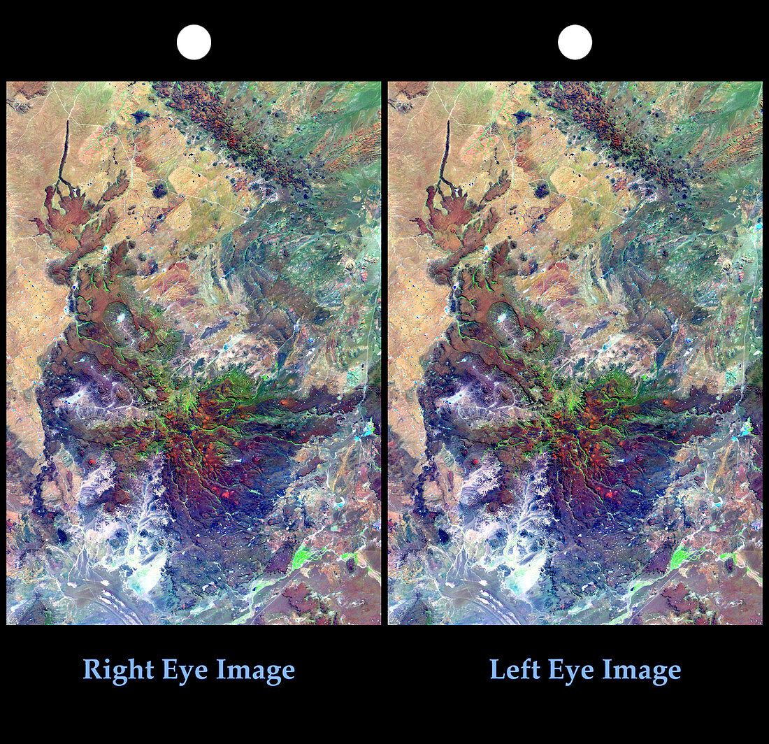
| Volcanic landscape. Satellite images of northern Patagonia at Los Menucos,Argentina. To view a stereoscopic 3D image,cross your eyes until a third white dot appears between the two dots at left and right,the central image is 3D. These images show a single volcano that has been deeply eroded (dark butterfly-shaped region at lower centre). A more recent volcanic cone with a long stream of larva can also be seen (upper left),along with a chain of small dark volcanic peaks (top). The volcanic formations are linked to a geographic fault that runs from upper centre to lower left. Image produced by combining Landsat 7 images taken on 22nd January and 19th February 2000 with data from the Shuttle Radar Topography Mission | |
| Lizenzart: | Lizenzpflichtig |
| Credit: | Science Photo Library / NIMA / JPL / NASA |
| Bildgröße: | 2995 px × 2898 px |
| Modell-Rechte: | nicht erforderlich |
| Eigentums-Rechte: | nicht erforderlich |
| Restrictions: | - |
Preise für dieses Bild ab 15 €
Universitäten & Organisationen
(Informationsmaterial Digital, Informationsmaterial Print, Lehrmaterial Digital etc.)
ab 15 €
Redaktionell
(Bücher, Bücher: Sach- und Fachliteratur, Digitale Medien (redaktionell) etc.)
ab 30 €
Werbung
(Anzeigen, Aussenwerbung, Digitale Medien, Fernsehwerbung, Karten, Werbemittel, Zeitschriften etc.)
ab 55 €
Handelsprodukte
(bedruckte Textilie, Kalender, Postkarte, Grußkarte, Verpackung etc.)
ab 75 €
Pauschalpreise
Rechtepakete für die unbeschränkte Bildnutzung in Print oder Online
ab 495 €
Keywords
- 2000,
- 21. Jahrhundert,
- 3-d,
- 3D,
- Argentinien,
- Dreidimensional,
- Erdbeobachtung,
- Erdkunde,
- erodiert,
- Erosion,
- Felsformation,
- geografisch,
- Geographie,
- Geologie,
- geologisch,
- Landsat 7,
- Landschaft,
- Lava,
- Mission,
- Satellit,
- Satellitenbild,
- SRTM,
- stereoskopisches Bild,
- Südamerika,
- Südamerikanisch,
- Topographie,
- Vulkan,
- Vulkangestein,
- vulkanisch,
- Vulkanologie,
- Weltall