Rift Valley volcanoes,satellite image
Bildnummer 11740786
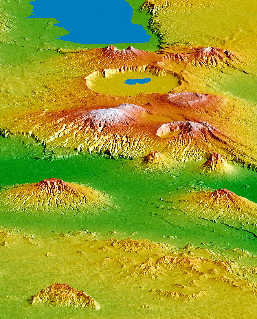
| Rift Valley volcanoes,satellite radar image. This is the Crater Highlands area in Tanzania,viewed from an orbiting Space Shuttle,looking south-west towards Lake Eyasi (top). The distance from top to bottom is 230 kilometres. Variation in elevation of the land is colour-coded,from green (lowest) to yellow,red and white (highest). Ngorongoro Crater (upper centre) has a lake inside it. Below that is Mount Loolmalasin (3648 metres),the highest peak in the area. Ela Naibori Crater is right of Loolmalasin. Other mountains include Kitumbeine (lower left) and Gelai (lower right). Image data obtained by the Shuttle Radar Topography Mission (SRTM) aboard the Space Shuttle Endeavour,which launched on 11 February 2000 | |
| Lizenzart: | Lizenzpflichtig |
| Credit: | Science Photo Library / NGA / JPL / NASA |
| Bildgröße: | 2657 px × 3292 px |
| Modell-Rechte: | nicht erforderlich |
| Eigentums-Rechte: | nicht erforderlich |
| Restrictions: | - |
Preise für dieses Bild ab 15 €
Universitäten & Organisationen
(Informationsmaterial Digital, Informationsmaterial Print, Lehrmaterial Digital etc.)
ab 15 €
Redaktionell
(Bücher, Bücher: Sach- und Fachliteratur, Digitale Medien (redaktionell) etc.)
ab 30 €
Werbung
(Anzeigen, Aussenwerbung, Digitale Medien, Fernsehwerbung, Karten, Werbemittel, Zeitschriften etc.)
ab 55 €
Handelsprodukte
(bedruckte Textilie, Kalender, Postkarte, Grußkarte, Verpackung etc.)
ab 75 €
Pauschalpreise
Rechtepakete für die unbeschränkte Bildnutzung in Print oder Online
ab 495 €